Area Overview for NR12 8QN
Photos of NR12 8QN
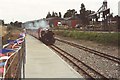
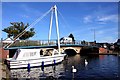
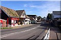
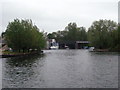
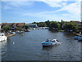
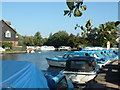
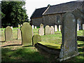
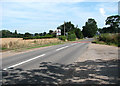
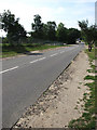
100 photos from this area
Area Information
Key information about the NR12 8QN including its size, population, and administrative classification.
- Area Type
- Postcode
- Area Size
- 15.7 hectares
- Population
- 2298
- Population Density
- 154 people/km²
House Prices in NR12 8QN
57
Properties
£312,634
Average Sold Price
£79,000
Lowest Price
£700,000
Highest Price
Showing 57 properties
| Address | Type | Beds | Baths | Last Sale Price | Last Sale Date | |
|---|---|---|---|---|---|---|
| 24 Tunstead Road, Hoveton, NR12 8QN | Terraced | 2 | 1 | £172,000 | Jun 2025 | |
| The Laurels, Tunstead Road, Hoveton, NR12 8QN | Detached | 6 | 2 | £325,000 | Oct 2024 | |
| Glenfield, Tunstead Road, Hoveton, NR12 8QN | Bungalow | 3 | 2 | £445,000 | Mar 2024 | |
| Dodmans, Tunstead Road, Hoveton, NR12 8QN | Bungalow | - | - | £585,000 | Jan 2023 | |
| The Knoll, Tunstead Road, Hoveton, NR12 8QN | Retail | 3 | 1 | £350,000 | Sep 2022 | |
| Ivydene, Tunstead Road, Hoveton, NR12 8QN | Bungalow | - | - | £675,000 | Jan 2022 | |
| Westbury Travers, Tunstead Road, Hoveton, NR12 8QN | Bungalow | - | - | £575,000 | Nov 2021 | |
| Dovedale, Tunstead Road, Hoveton, NR12 8QN | house | - | - | £368,000 | Mar 2021 | |
| Tarn Hows, Tunstead Road, Hoveton, NR12 8QN | Bungalow | 6 | 3 | £620,000 | Jan 2021 | |
| Delaware, Tunstead Road, Hoveton, NR12 8QN | Detached | 4 | 3 | £440,000 | Oct 2020 |
Page 1 of 6
Energy Efficiency in NR12 8QN
Amenities
Schools
| Rank | School | Type | Entry gender | Ages |
|---|
Explore more schools in this area
Go to Schools tabDemographics
Household Size
Two person
most common
Accommodation Type
Houses
most common
Tenure
74
majority
Ethnic Group
White
most common
Religion
N/A
most common
Household Composition
N/A
most common
Age
47
median
Elderly (65+ years)
most common
Household Deprivation
N/A
with no deprivation
NS-SEC
29
in Lower managerial occupations
Explore more demographic insights in this area
Go to Demographics tabPlanning
Planning Constraints
- Flood RiskPremium
- Ramsar Wetland SitesPremium
- Area of Outstanding Natural BeautyPremium
- Protected Nature ReservePremium
- Protected WoodlandPremium