Area Overview for NR12 8NL
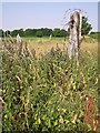
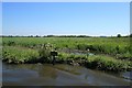
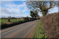
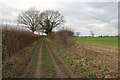
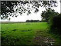
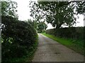
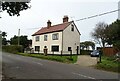
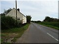
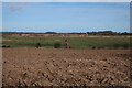
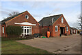
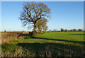
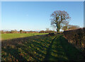
Photos of NR12 8NL
Area Information
Living in NR12 8NL offers a distinctly rural experience within Norfolk, characterised by quiet residential clusters rather than dense urban development. This specific postcode covers a small area of 18 hectares, accommodating a population of 2,061 residents. The density here is remarkably low, standing at just 71 people per square kilometre. You will find yourself far removed from the congestion and noise of larger towns, enjoying spacious surroundings that define life at this scale. The postcode represents a settled community where daily life revolves around the immediate neighbourhood and nearby villages rather than city centres. Prospective buyers should expect a peaceful environment where the pace of life is dictated by the seasons and local rhythms. The small size of the area means that community life is tight-knit, with neighbours often knowing one another by name. Daily necessities are accessed through a network of local services rather than immediate proximity within the cluster itself. This setting suits those who prioritise tranquility and space over the convenience of being centrally located in a major town.
- Area Type
- Postcode
- Area Size
- 18.0 hectares
- Population
- 2061
- Population Density
- 71 people/km²
The property market in NR12 8NL is overwhelmingly characterised by owner-occupied homes. With 78 per cent of households owning their property, the area functions as a retirement and family nest rather than a student hub or rental hotspot. The predominant accommodation type consists entirely of houses, meaning you will not find any flats or high-rise apartments within this 18-hectare cluster. This housing stock reflects a traditional rural aesthetic suited to the Norfolk countryside. Buyers seeking these homes can expect a settled market where price retention is often driven by the scarcity of stock rather than aggressive capital growth. The low density of 71 people per square kilometre ensures that each residence has considerable grounds and privacy compared to urban equivalents. When purchasing homes in NR12 8NL, you are joining a community of long-term residents who value the quiet life. The market is not subject to the rapid turnover seen in city centres, allowing homeowners to enjoy their property with minimal disruption. This stability makes the area attractive for those prioritising peace of mind over investment volatility.
House Prices in NR12 8NL
Showing 5 properties
| Address | Type | Beds | Baths | Last Sale Price | Last Sale Date | |
|---|---|---|---|---|---|---|
| Greenleas, Upper Street, Horning, NR12 8NL | Bungalow | - | - | £217,000 | Nov 2012 | |
| Church Farm, Upper Street, Horning, NR12 8NL | Detached | 4 | 2 | - | - | |
| 2 Church View, Upper Street, Horning, NR12 8NL | Detached | 3 | 1 | - | - | |
| St Benets Cottage, Upper Street, Horning, NR12 8NL | Detached | - | - | - | - | |
| West Cottage, 13 Upper Street, Horning, NR12 8NL | Semi-detached | - | - | - | - |
Energy Efficiency in NR12 8NL
Daily life in NR12 8NL revolves around a network of small towns and villages within easy reach. Wroxham stands out as the nearest major metro and leisure hub, offering restaurants, pubs, and hotels for those seeking a night out or weekend break. For everyday shopping, several retailers provide essential services without requiring travel to major city centres. East of England Co-operative Co offers a range of groceries and household items, satisfying most weekly shopping needs. M&S Acle BP provides need-to-buy fashion and essentials, while Morrisons Daily serves as another key supermarket option for fresh produce and family goods. Five railway stations are accessible, including Hoveton & Wroxham Railway Station, Salhouse Railway Station, and Acle Railway Station. This rail network connects you to York and London King's Cross, integrating you into the national transport web. These six amenities distributed across the region ensure that convenience does not suffer simply because your postcode is rural. You enjoy the countryside without sacrificing access to food, retail therapy, and public transport.
Amenities
Schools
Families living in NR12 8NL benefit from two highly rated primary schools within practical commuting distance. Neatishead Church of England Primary School holds an outstanding Ofsted rating and serves as a flagship educational institution for the region. It represents a top-tier choice for parents seeking a school with a proven track record of academic excellence. Horning Community Primary School also operates locally and carries a good Ofsted rating. Having one outstanding and one good primary option nearby ensures you have flexibility in school admissions without needing to travel significant distances for early education. There are no secondary schools listed in the data for this immediate cluster, implying that older children will likely commute to larger towns such as Diss or Great Yarmouth for further education. For those with primary-aged children, the local cluster offers quality education without the need for a dedicated school run. The combination of high-rated primary options supports families who wish to keep their young children close while ensuring a strong start to their academic journey.
| Rank | School | Type | Entry gender | Ages |
|---|
Explore more schools in this area
Go to Schools tabDemographics
The community profile of NR12 8NL reflects a mature and established population. The median age is 47 years, with adults between 30 and 64 years forming the most common age range. This demographic shift indicates a neighbourhood dominated by families with young children and homeowners nearing retirement, rather than young professionals or students. Home ownership is extremely high, with 78 per cent of residents owning their property outright or with a mortgage. Consequently, the local estate is defined by stability and long-term residency. The predominant ethnic group is White, mirroring the broader historical settlement patterns of rural Norfolk. Almost all residents live in houses, creating a consistent architectural landscape across the postcode. There are no significant rental pockets or high-density developments within this cluster. The absence of deprived areas is not explicitly flagged in the available metrics, suggesting a uniformly middle-class or above standard of living. You are looking at an area where residents have likely built their lives over decades, valuing stability and community cohesion above transient living options.
Household Size
Accommodation Type
Tenure
Ethnic Group
Religion
Household Composition
Age
Household Deprivation
NS-SEC
Explore more demographic insights in this area
Go to Demographics tabPlanning
Planning Constraints
- Flood RiskPremium
- Ramsar Wetland SitesPremium
- Area of Outstanding Natural BeautyPremium
- Protected Nature ReservePremium
- Protected WoodlandPremium