Area Overview for NR12 8JW
Photos of NR12 8JW
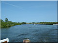
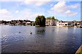
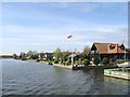
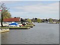
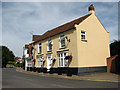

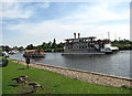
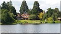
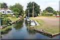
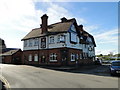
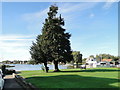
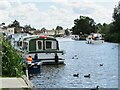
72 photos from this area
Area Information
Key information about the NR12 8JW including its size, population, and administrative classification.
- Area Type
- Postcode
- Area Size
- 40.3 hectares
- Population
- 2298
- Population Density
- 154 people/km²
House Prices in NR12 8JW
18
Properties
£583,811
Average Sold Price
£80,000
Lowest Price
£1,200,000
Highest Price
Showing 18 properties
| Address | Type | Beds | Baths | Last Sale Price | Last Sale Date | |
|---|---|---|---|---|---|---|
| Halberry, Horning Road, Hoveton, NR12 8JW | Bungalow | 3 | 3 | £1,200,000 | Aug 2022 | |
| Quiet Waters, Horning Road, Hoveton, NR12 8JW | Detached | - | - | £550,000 | Feb 2018 | |
| Little Broad House, Horning Road, Hoveton, NR12 8JW | house | 3 | - | £820,000 | Nov 2012 | |
| Little Crabbetts, Horning Road, Hoveton, NR12 8JW | Detached | 3 | - | £820,300 | Dec 2007 | |
| Run Cottage, Horning Road, Hoveton, NR12 8JW | Detached | 4 | 2 | £425,000 | Jan 2004 | |
| Woodbury, Horning Road, Hoveton, NR12 8JW | Detached | - | - | £695,000 | Oct 2003 | |
| The Run, Horning Road, Hoveton, NR12 8JW | Detached | - | - | £500,000 | Sep 2003 | |
| Half Acre, Horning Road, Hoveton, NR12 8JW | Detached | 4 | - | £164,000 | Nov 2000 | |
| The Old Pump House, Horning Road, Hoveton, NR12 8JW | Semi-detached | - | - | £80,000 | Jul 1999 | |
| Burwood House, Horning Road, Hoveton, NR12 8JW | Detached | 5 | 3 | - | - |
Page 1 of 2
Energy Efficiency in NR12 8JW
Amenities
Schools
| Rank | School | Type | Entry gender | Ages |
|---|
Explore more schools in this area
Go to Schools tabDemographics
Household Size
Two person
most common
Accommodation Type
Houses
most common
Tenure
74
majority
Ethnic Group
White
most common
Religion
N/A
most common
Household Composition
N/A
most common
Age
47
median
Elderly (65+ years)
most common
Household Deprivation
N/A
with no deprivation
NS-SEC
29
in Lower managerial occupations
Explore more demographic insights in this area
Go to Demographics tabPlanning
Planning Constraints
- Flood RiskPremium
- Ramsar Wetland SitesPremium
- Area of Outstanding Natural BeautyPremium
- Protected Nature ReservePremium
- Protected WoodlandPremium