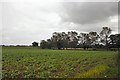
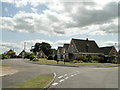
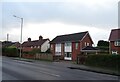
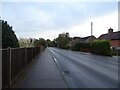
Area Overview for NR12 8GJ
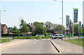
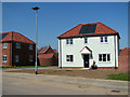
Photos of NR12 8GJ


Area Information
Living in NR12 8GJ means settling into a specific postcode area that covers a small residential cluster spanning three hectares. With a population of 2,298 residents, this neighbourhood maintains a low population density of 154 people per square kilometre. You will find a predominantly domestic setting characterised by detached and semi-detached housing rather than high-density flats or apartments. The local environment benefits from a clear safety profile, with no coverage of Ramsar wetland sites, Areas of Outstanding Natural Beauty, protected nature reserves, or protected woodland that might constrain development. Instead, the focus remains on the established cluster of homes within this rural-like context. Prospective buyers seeking a quiet, self-contained living experience will appreciate the space this area offers. The setting avoids major planning constraints, ensuring the residential character remains distinct from protected environmental zones. Daily life here revolves around proximity to nearby rail stations and shopping facilities rather than urban density. You are not looking at a bustling city centre; you are looking at a settled, low-density community where every resident within the 2,298-strong population contributes to a calm atmosphere. The area stands as a practical choice for those who want established housing without the constraints or crowding found in larger towns.
- Area Type
- Postcode
- Area Size
- 3.0 hectares
- Population
- 2298
- Population Density
- 154 people/km²
The property market in NR12 8GJ is defined by a housing stock that consists entirely of houses. There are no flats, apartments, or high-density accommodation types within this specific cluster, which creates a uniform character for anyone viewing homes in the area. With home ownership standing at 74 per cent, the vast majority of these houses are owner-occupied rather than investor portfolios or student rentals. This means you are purchasing a residence from a resident who is likely to stay for the long term, reducing the risk of sudden property turnover. The market here caters to those seeking a traditional house rather than a conversion or a block of flats. Buyers looking at this small area and its immediate surroundings understand that they are entering an established market rather than a speculative one. The exclusive nature of the housing stock appeals to families and professionals who value garden space and single-family living. While the area lacks the volume of a larger town, the consistency of the housing type offers predictability for buyers. You are not competing in a competitive, high-rise market; you are engaging with a stable sector where house prices reflect the value of solid, owner-occupied homes. The 74 per cent ownership rate further signals that this is a reliable area for investment or family relocation where the community is anchored by long-term residents.
House Prices in NR12 8GJ
Showing 52 properties
| Address | Type | Beds | Baths | Last Sale Price | Last Sale Date | |
|---|---|---|---|---|---|---|
| 16 Burnt Fen Way, Hoveton, NR12 8GJ | Semi-detached | 3 | 2 | £245,000 | Nov 2025 | |
| 41 Burnt Fen Way, Hoveton, NR12 8GJ | Bungalow | - | - | £400,000 | Nov 2025 | |
| 51 Burnt Fen Way, Hoveton, NR12 8GJ | Terraced | 2 | 1 | £98,000 | Aug 2023 | |
| 10 Burnt Fen Way, Hoveton, NR12 8GJ | Detached | 4 | 3 | £425,000 | Nov 2022 | |
| 2 Burnt Fen Way, Hoveton, NR12 8GJ | Detached | 3 | 1 | £325,000 | Jun 2021 | |
| 14 Burnt Fen Way, Hoveton, NR12 8GJ | Semi-detached | 3 | 2 | £215,000 | Aug 2020 | |
| 57 Burnt Fen Way, Hoveton, NR12 8GJ | Semi-detached | 3 | 1 | £210,000 | Jan 2020 | |
| 55 Burnt Fen Way, Hoveton, NR12 8GJ | Detached | 2 | 1 | £97,500 | Dec 2019 | |
| 47 Burnt Fen Way, Hoveton, NR12 8GJ | Terraced | 2 | - | £195,000 | Dec 2019 | |
| 12 Burnt Fen Way, Hoveton, NR12 8GJ | Semi-detached | 3 | 2 | £215,000 | Mar 2019 |
Energy Efficiency in NR12 8GJ
Your lifestyle in NR12 8GJ centres on accessibility to nearby amenities within a practical driving distance. You can reach Wroxham, a prominent metro location, which offers broader leisure and cultural opportunities. Local shopping is supported by three notable retailers: East of England Co-operative Co, Lidl Sprowston, and Tesco Norwich. These stores provide your weekly groceries and essential household goods without requiring a lengthy journey into a major city. Transport links are strong with three railway stations nearby: Hoveton and Wroxham Railway Station, Salhouse Railway Station, and Worstead Railway Station. This rail network connects you to wider destinations efficiently. You have five key retail outlets identified as the nearest shops, ensuring convenience for daily errands. The area is not isolated; it sits within reach of established commercial centres and transport hubs that serve the East of England region. Dining options and socializing are available at these named retail locations alongside the train stations. You are positioned to utilise the retail presence at Lidl Sprowston and Tesco Norwich for routine needs. The combination of these metro, rail, and retail nodes ensures that your daily conveniences are never more than a short trip away, balancing the quiet nature of the residential cluster with easy access to town facilities.
Amenities
Schools
Families living in NR12 8GJ benefit from access to specific educational institutions within practical reach. The primary education option is St John's Community Primary School and Nursery, which holds a good Ofsted rating. This school provides a recognised standard of education for younger children. Neighbours also utilise Broadland High School, another primary institution located nearby that serves the local catchment area. For older children requiring secondary education, Broadland High Ormiston Academy stands as the key academy option in the vicinity. The mix of schools includes both a well-regarded community primary with a formal rating and academy-contracted options that emphasise centralised educational approaches. You have access to at least two primary providers and one secondary academy without needing to travel far outside the immediate neighbourhood. The presence of St John's Community Primary School and Nursery with its specific good rating provides a tangible benchmark for primary education quality. Prospective homebuyers will find that the local education supply meets the needs of children from the child age group through to secondary years. This combination of schools ensures that living in NR12 8GJ involves manageable daily commutes for schooling rather than long-distance transport requirements for education.
| Rank | School | Type | Entry gender | Ages |
|---|
Explore more schools in this area
Go to Schools tabDemographics
The community in NR12 8GJ reflects a settled demographic profile with a median age of 47 years. The most common age range among residents covers elderly people aged 65 years and over, indicating a neighbourhood known for stability and longer-term tenures. This age structure correlates strongly with the high home ownership level of 74 per cent within the area. The vast majority of the population owns their property outright or with a mortgage, suggesting a community invested in the local environment and resistant to rapid turnover. You will encounter a predominantly white population as the predominant ethnic group within this residential cluster. Families with young children may find the age skew towards the elderly less conducive to a bustling parade of school-run traffic, yet this demographic reality creates a quieter street environment. The accommodation type is exclusively houses, reinforcing the owner-occupied nature of the street. When you consider quality of life, the high ownership percentage often translates to better maintained properties and a stronger sense of local responsibility among neighbours. The estate avoids the transient feel of student housing or rental blocks, offering a consistent community environment where residents have lived for decades. This stability is evident in the resident composition and the enduring nature of the housing stock.
Household Size
Accommodation Type
Tenure
Ethnic Group
Religion
Household Composition
Age
Household Deprivation
NS-SEC
Explore more demographic insights in this area
Go to Demographics tabPlanning
Planning Constraints
- Flood RiskPremium
- Ramsar Wetland SitesPremium
- Area of Outstanding Natural BeautyPremium
- Protected Nature ReservePremium
- Protected WoodlandPremium