Area Overview for NR12 7BA
Photos of NR12 7BA
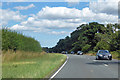
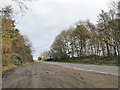
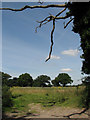

9 photos from this area
Area Information
Key information about the NR12 7BA including its size, population, and administrative classification.
- Area Type
- Postcode
- Area Size
- 82.4 hectares
- Population
- 1605
- Population Density
- 106 people/km²
House Prices in NR12 7BA
13
Properties
£260,333
Average Sold Price
£30,000
Lowest Price
£900,000
Highest Price
Showing 13 properties
| Address | Type | Beds | Baths | Last Sale Price | Last Sale Date | |
|---|---|---|---|---|---|---|
| Long Field House, Norwich Road, Horstead With Stanninghall, NR12 7BA | Detached | 7 | 5 | £900,000 | Mar 2019 | |
| Rose Cottage, Norwich Road, Horstead With Stanninghall, NR12 7BA | Terraced | 3 | 2 | £165,000 | Jan 2014 | |
| Hill House, Norwich Road, Horstead With Stanninghall, NR12 7BA | house | - | - | £385,000 | Apr 2010 | |
| Sha-way Cottage, Norwich Road, Horstead With Stanninghall, NR12 7BA | Terraced | - | - | £42,000 | Jul 1997 | |
| Bridge Cottage, Norwich Road, Horstead With Stanninghall, NR12 7BA | Cottage | 2 | - | £40,000 | Jun 1996 | |
| Bluebell Cottage, Norwich Road, Horstead With Stanninghall, NR12 7BA | Bungalow | 3 | 1 | £30,000 | Jul 1995 | |
| Elm Tree Cottage, Norwich Road, Horstead With Stanninghall, NR12 7BA | Cottage | 3 | 2 | - | - | |
| Hollyhocks, Norwich Road, Horstead With Stanninghall, NR12 7BA | Bungalow | - | - | - | - | |
| Holmes Garage Services, Norwich Road, Horstead With Stanninghall, NR12 7BA | Industrial | - | - | - | - | |
| Hill Farm, Norwich Road, Horstead With Stanninghall, NR12 7BA | Terraced | - | - | - | - |
Page 1 of 2
Energy Efficiency in NR12 7BA
Amenities
Schools
| Rank | School | Type | Entry gender | Ages |
|---|
Explore more schools in this area
Go to Schools tabDemographics
Household Size
Two person
most common
Accommodation Type
Houses
most common
Tenure
74
majority
Ethnic Group
White
most common
Religion
N/A
most common
Household Composition
N/A
most common
Age
47
median
Adults (30-64 years)
most common
Household Deprivation
N/A
with no deprivation
NS-SEC
38
in Lower managerial occupations
Explore more demographic insights in this area
Go to Demographics tabPlanning
Planning Constraints
- Flood RiskPremium
- Ramsar Wetland SitesPremium
- Area of Outstanding Natural BeautyPremium
- Protected Nature ReservePremium
- Protected WoodlandPremium