Area Overview for NR12 7AQ
Photos of NR12 7AQ

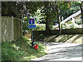
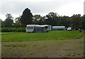
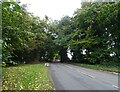
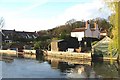
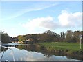
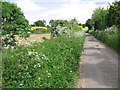
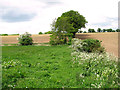
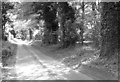

17 photos from this area
Area Information
Key information about the NR12 7AQ including its size, population, and administrative classification.
- Area Type
- Postcode
- Area Size
- 27.2 hectares
- Population
- 1605
- Population Density
- 106 people/km²
House Prices in NR12 7AQ
36
Properties
£435,975
Average Sold Price
£35,000
Lowest Price
£1,300,000
Highest Price
Showing 36 properties
| Address | Type | Beds | Baths | Last Sale Price | Last Sale Date | |
|---|---|---|---|---|---|---|
| Anchor House, 18 Anchor Street, Coltishall, NR12 7AQ | Detached | 5 | 4 | £1,300,000 | Mar 2025 | |
| Belmont, 52 Anchor Street, Coltishall, NR12 7AQ | Terraced | 3 | 1 | £450,000 | Jan 2025 | |
| Anchor Wood, 3 Anchor Street, Coltishall, NR12 7AQ | Detached | 5 | 3 | £1,000,000 | Oct 2022 | |
| Boatyard Maltings, 26 Anchor Street, Coltishall, NR12 7AQ | Terraced | 3 | 2 | £419,000 | Nov 2021 | |
| Burebank House, 4 Anchor Street, Coltishall, NR12 7AQ | house | 4 | - | £906,000 | Jun 2021 | |
| Landfall, 8 Anchor Street, Coltishall, NR12 7AQ | Bungalow | 3 | 1 | £640,000 | Sep 2020 | |
| Home Port, 6 Anchor Street, Coltishall, NR12 7AQ | house | 4 | 1 | £645,000 | Feb 2019 | |
| Boatyard Maltings, 30 Anchor Street, Coltishall, NR12 7AQ | house | - | - | £457,000 | Nov 2018 | |
| Boatyard Maltings, 24 Anchor Street, Coltishall, NR12 7AQ | Semi-detached | 4 | 2 | £385,000 | Dec 2017 | |
| Wherry Quayside, 38 Anchor Street, Coltishall, NR12 7AQ | Terraced | 3 | 1 | £340,000 | Feb 2017 |
Page 1 of 4
Energy Efficiency in NR12 7AQ
Amenities
Schools
| Rank | School | Type | Entry gender | Ages |
|---|
Explore more schools in this area
Go to Schools tabDemographics
Household Size
Two person
most common
Accommodation Type
Houses
most common
Tenure
74
majority
Ethnic Group
White
most common
Religion
N/A
most common
Household Composition
N/A
most common
Age
47
median
Adults (30-64 years)
most common
Household Deprivation
N/A
with no deprivation
NS-SEC
38
in Lower managerial occupations
Explore more demographic insights in this area
Go to Demographics tabPlanning
Planning Constraints
- Flood RiskPremium
- Ramsar Wetland SitesPremium
- Area of Outstanding Natural BeautyPremium
- Protected Nature ReservePremium
- Protected WoodlandPremium