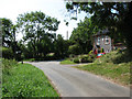
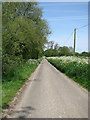
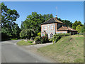
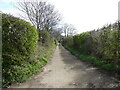
Area Overview for NR12 0TL
Photos of NR12 0TL

Area Information
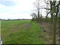
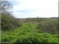
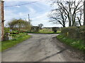
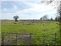
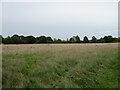
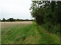
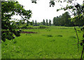
Living in NR12 0TL offers a quiet residential experience within a compact 38.2-hectare cluster. This specific postcode covers a small, contained community with a population of 2,020 residents. The area sits at a population density of 44 people per square kilometre, creating an environment where neighbours know each other. You will find a settlement defined by its manageable scale and proximity to the coast. There is no grandeur in the statistics here, just a straightforward cluster of homes and residences. The geography is low-key, avoiding protected landscapes like Areas of Outstanding Natural Beauty or Ramsar wetland sites. This simplicity defines daily life for those choosing to settle in this corner of Norfolk. You are looking at a place where the focus remains on the immediate neighbourhood rather than complex planning constraints or large-scale developments. The atmosphere is one of established routine, far removed from the pressures of major urban centres. For those seeking a hidden gem away from the crowds, NR12 0TL delivers a straightforward, no-nonsense living environment. It is a place where the sand and salt air play a part in the local character, even if specific environmental scores are reserved for safety and planning assessments.
- Area Type
- Postcode
- Area Size
- 38.2 hectares
- Population
- 2020
- Population Density
- 44 people/km²
The property market in NR12 0TL is characterised by traditional housing and high levels of ownership. With 74% of residents being homeowners, the area is defined by families and individuals who have put down roots rather than transient tenants. The accommodation type data confirms that you will find exclusively houses available here. There are no apartments or flats listed for this specific 38.2-hectare cluster, so expectations should be set for single-family or semi-detached dwellings. This concentration of house ownership means the local property market moves with the pace of home buyers rather than the rental sector. When considering homes in NR12 0TL, you are dealing with a market where existing owners often look to upgrade or move within the local cluster. The low population of 2,020 suggests limited inventory compared to larger towns, so competition can be fierce for the right property. You are not in a hub with hundreds of new developments; every listing represents a significant deal for the local community. The fact that almost all residents own their homes indicates that land prices and house values have remained relatively stable for most occupants. If you are looking to purchase a house in this quiet Nebia-adjacent or coastal fringe area, you are entering a market driven by personal utility and family needs rather than investing speculation.
House Prices in NR12 0TL
Showing 3 properties
| Address | Type | Beds | Baths | Last Sale Price | Last Sale Date | |
|---|---|---|---|---|---|---|
| Ingham Hall, Long Lane, Ingham Corner, Ingham, NR12 0TL | Retail | 3 | 1 | - | - | |
| The Lodge, Long Lane, Ingham Corner, Ingham, NR12 0TL | house | - | - | - | - | |
| Ingham Hall Cottage, Long Lane, Ingham Corner, Ingham, NR12 0TL | Detached | - | - | - | - |
Energy Efficiency in NR12 0TL
Your daily life in NR12 0TL revolves around a limited but essential set of nearby amenities. Retail options are sparse, with just two main stores located within practical reach. These are Morrisons Daily and Tesco Norwich, which serve as the primary sources for groceries and household shopping. You will not find a high street filled with restaurants, bars, or boutiques in this immediate cluster of 2,020 people. For those needing a wider range of goods, you must travel to nearest city centres or larger towns. Transport links are similarly constrained, with only one railway station identified nearby: Worstead Railway Station. This single rail option dictates your commuting patterns and travel planning to London or other major destinations. There are no substantial leisure complexes, parks, or cinemas listed in the immediate vicinity data. Your lifestyle therefore depends heavily on your own vehicle and the distance you are willing to travel for entertainment. The area functions best for those who value quiet living over instant access to culture or dining. Shopping trips become planned events rather than daily errands, which fits the slower tempo of living in such a small residential zone.
Amenities
Schools
Families living in NR12 0TL have access to a dedicated mix of educational institutions within practical reach. East Ruston Area Infant School serves the primary education needs of younger children in the locality. Nearby, East Ruston Infant School and Nursery operates as an academy and holds a good Ofsted rating, ensuring a standard of quality recognised by regulators. For children with specific educational needs, All Saints School provides special education services and also carries a good Ofsted rating. The Stables Independent School offers an alternative independent option and shares the same good rating status. You will also find The Old Vicarage and The Stables as part of the special education landscape for the wider region. This variety means that living in NR12 0TL does not strictly limit you to one type of schooling, though the closest provision includes the infant school in East Ruston. The presence of multiple schools rated 'good' offers reassurance regarding the standard of care and education available. Parents can choose between academy models, special needs provisions, or independent settings depending on their family's requirements. The proximity of these named institutions ensures that education is a tangible part of daily life for families residing in this postcode.
| Rank | School | Type | Entry gender | Ages |
|---|
Explore more schools in this area
Go to Schools tabDemographics
The community in NR12 0TL reflects a mature household structure. The median age is 47 years, indicating that most residents fall into the adult demographic between 30 and 64 years old. This age profile suggests a neighbourhood built for stability rather than rapid student turnover or young families just starting out. Homeownership is the dominant form of living, with 74% of residents owning their properties outright or with a mortgage. Conversely, only a small minority rents their accommodation. Almost all homes in NR12 0TL are houses, meaning you will not find high-rise blocks or purpose-built flats in this cluster. The population is predominantly White, aligning with the broader demographic trends of the region. You are living in an area where long-term residents have likely settled decades ago, creating tight-knit social circles. The high ownership rate of three-quarters implies financial stability among those who make the move to this postcode. There is no data suggesting significant deprivation or poverty rates, but the low density of 44 people per square kilometre naturally supports a slower pace of life. The demographic makeup confirms this is a settled family and mature resident zone, distinct from areas dominated by students or young professionals.
Household Size
Accommodation Type
Tenure
Ethnic Group
Religion
Household Composition
Age
Household Deprivation
NS-SEC
Explore more demographic insights in this area
Go to Demographics tabPlanning
Planning Constraints
- Flood RiskPremium
- Ramsar Wetland SitesPremium
- Area of Outstanding Natural BeautyPremium
- Protected Nature ReservePremium
- Protected WoodlandPremium