Area Overview for NR12 0LZ
Photos of NR12 0LZ
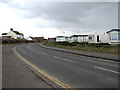
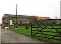
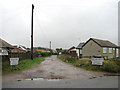
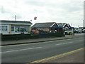
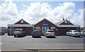
95 photos from this area
Area Information
Key information about the NR12 0LZ including its size, population, and administrative classification.
- Area Type
- Postcode
- Area Size
- 2.1 hectares
- Population
- 2361
- Population Density
- 67 people/km²
House Prices in NR12 0LZ
16
Properties
£194,925
Average Sold Price
£19,000
Lowest Price
£375,000
Highest Price
Showing 16 properties
| Address | Type | Beds | Baths | Last Sale Price | Last Sale Date | |
|---|---|---|---|---|---|---|
| Beachcomber, Poplar Drive, Walcott, NR12 0LZ | Bungalow | 3 | 1 | £280,000 | Nov 2024 | |
| 4, The Cedars, Poplar Drive, Walcott, NR12 0LZ | Bungalow | 2 | 1 | £375,000 | Nov 2023 | |
| 3, The Cedars, Poplar Drive, Walcott, NR12 0LZ | Detached | 2 | 1 | £335,000 | Sep 2023 | |
| 1, The Cedars, Poplar Drive, Walcott, NR12 0LZ | Bungalow | 2 | 2 | £270,000 | Aug 2021 | |
| 5, The Cedars, Poplar Drive, Walcott, NR12 0LZ | Bungalow | 2 | 1 | £257,500 | Jun 2021 | |
| Seafield, Poplar Drive, Walcott, NR12 0LZ | Bungalow | 2 | 1 | £146,000 | Dec 2019 | |
| The Oaks, Poplar Drive, Walcott, NR12 0LZ | Bungalow | 3 | 2 | £230,000 | Sep 2019 | |
| Vikings, Poplar Drive, Walcott, NR12 0LZ | Bungalow | 2 | 1 | £155,000 | Jan 2018 | |
| Silver Sands, Poplar Drive, Walcott, NR12 0LZ | Bungalow | 3 | - | £158,000 | Oct 2016 | |
| Marigold, Poplar Drive, Walcott, NR12 0LZ | Bungalow | 3 | - | £150,000 | Dec 2015 |
Page 1 of 2
Energy Efficiency in NR12 0LZ
Amenities
Schools
| Rank | School | Type | Entry gender | Ages |
|---|
Explore more schools in this area
Go to Schools tabDemographics
Household Size
Two person
most common
Accommodation Type
Houses
most common
Tenure
74
majority
Ethnic Group
White
most common
Religion
N/A
most common
Household Composition
N/A
most common
Age
47
median
Adults (30-64 years)
most common
Household Deprivation
N/A
with no deprivation
NS-SEC
29
in Lower managerial occupations
Explore more demographic insights in this area
Go to Demographics tabPlanning
Planning Constraints
- Flood RiskPremium
- Ramsar Wetland SitesPremium
- Area of Outstanding Natural BeautyPremium
- Protected Nature ReservePremium
- Protected WoodlandPremium