Area Overview for NR11 8SB
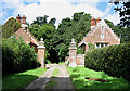
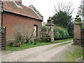
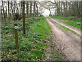
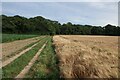
Photos of NR11 8SB
Area Information
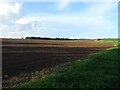
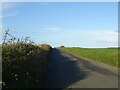
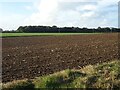
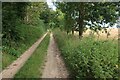
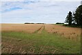
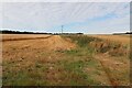
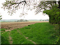
Living in NR11 8SB offers a quiet residential experience within a small cluster covering 1.3 km². This specific postcode serves a population of 2,356 residents, creating a low-density neighbourhood with minimal traffic congestion. The area sits just a few minutes from Cromer, allowing access to coastal towns while maintaining a peaceful, rural character. You will find this location attracts those who prioritise space and seclusion over urban buzz. The average density of 85 people per kilometre square confirms that housing is spread out rather than packed closely together. For families or individuals seeking a calm environment, this setting provides an ideal backdrop for daily life. You do not face the noise pollution common in larger districts, yet practical connectivity to nearby villages remains straightforward. The zone is defined by its residential focus rather than commercial activity. If you value a slower pace, you will find the neighbourhood aligns well with your lifestyle needs. Prospective buyers often appreciate that the area feels established yet unspoilt by large-scale development projects.
- Area Type
- Postcode
- Area Size
- 1.3 km²
- Population
- 2356
- Population Density
- 85 people/km²
The housing market in NR11 8SB is defined by a strong preference for freehold housing. With 76 per cent of homes owned by residents, the area functions primarily as an owner-occupied district rather than a rental hub. The accommodation type is exclusively houses, so you will not find apartments or converted flats within this postcode boundary. This structure typically appeals to families seeking gardens, private entrances, and long-term stability. Buyers looking to invest can expect a market dominated by detached or semi-detached properties. The high ownership ratio suggests that the local economy supports mortgage holders rather than relying on the private rental sector. When viewing properties, you will notice fewer new developments and more established stock. This limited supply often drives values upward steadily over time. If you are purchasing to live in rather than flip for profit, the market offers security and consistency. The character of the stock remains traditional, matching the modest area size of 1.3 km².
House Prices in NR11 8SB
Showing 2 properties
| Address | Type | Beds | Baths | Last Sale Price | Last Sale Date | |
|---|---|---|---|---|---|---|
| Marble Hill Lodge South, Metton Road, Felbrigg, NR11 8SB | Bungalow | 3 | - | - | - | |
| Marble Hill Lodge North, Metton Road, Felbrigg, NR11 8SB | Bungalow | - | - | - | - |
Energy Efficiency in NR11 8SB
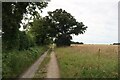
Daily life in NR11 8SB benefits from practical access to essential retail and transport hubs. Within a practical driving distance, you will find five key retail locations including Spar, Lidl Cromer, and Co-op Cromer. These supermarkets provide everything from fresh ingredients to household goods without the need for long journeys. Transport options are equally accessible. Five railway stations lie within easy reach, including Roughton Road, Cromer, and West Runton Railway Station. You can utilise these lines to commute to larger towns or connect with national rail networks. One metro stop in Weybourne adds further convenience for those needing access to wider city centres. While the 1.3 km² area itself lacks these venues, their proximity ensures you do not sacrifice convenience for quiet living. You can run regular errands, shop for groceries, and catch trains without feeling isolated. This blend of rural living and urban access defines the character of NR11 8SB for most residents.
Amenities
Schools
Families living in NR11 8SB rely on two primary schools nearby. St. Mary's (Endowed) CofE VA Primary School serves the local infant and junior populations. St Mary's Church of England Primary Academy also operates within the immediate vicinity as an alternative choice for parents. Both institutions provide faith-based education, likely influencing the upbringing of many children in the neighbourhood. While specific Ofsted ratings are not listed in the available information, the presence of two designated Church of England academies indicates a well-supported educational cluster. You have the option to choose between these two established primary institutions. This mix offers competitive entry points for local pupils seeking religious education combined with standard primary curriculum delivery. Neither school appears to be a single-sex specialist, suggesting a co-educational environment familiar to most British parents. The proximity of these schools means you do not need to commute far to ensure your children receive quality primary education.
| Rank | School | Type | Entry gender | Ages |
|---|
Explore more schools in this area
Go to Schools tabDemographics
The community in NR11 8SB is dominated by adults aged between 30 and 64 years. The median age stands at 47 years, reflecting a settlement largely populated by working families and established households rather than young professionals or retirees. Home ownership is exceptionally high, with 76 per cent of residents owning their properties outright or with a mortgage. This figure indicates a mature market where families have settled permanently rather than viewing the area as a temporary stepping stone. The predominant accommodation type consists of houses, reinforcing the family-oriented nature of the neighbourhood. You will encounter very few purpose-built flats or high-density blocks in this section. The ethnic composition is predominantly White, which aligns with the broader historic character of many Norfolk villages. This demographic profile suggests a stable community where neighbours often know each other well. The age distribution means you are unlikely to encounter transient populations, providing a consistent social fabric for children of all ages to grow up safely.
Household Size
Accommodation Type
Tenure
Ethnic Group
Religion
Household Composition
Age
Household Deprivation
NS-SEC
Explore more demographic insights in this area
Go to Demographics tabPlanning
Planning Constraints
- Flood RiskPremium
- Ramsar Wetland SitesPremium
- Area of Outstanding Natural BeautyPremium
- Protected Nature ReservePremium
- Protected WoodlandPremium