Area Overview for NR11 8NZ
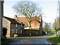
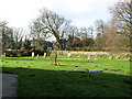
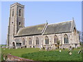
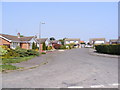
Photos of NR11 8NZ


Area Information
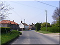
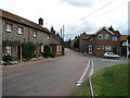
NR11 8NZ represents a small residential cluster in England, covering an area of 2971 square metres. This specific postcode serves a single community of 2356 people, resulting in a population density of 85 people per square kilometre. The low density indicates a spread-out living environment where residents likely experience less immediate congestion than found in denser urban centres. You are looking at a neighbourhood designed for housing rather than high-density urban living. The size and population figures suggest a quiet, manageable scale where daily life proceeds at a measured pace. Families and individuals reside here within a distinct fraction of a postcode district. Living in NR11 8NZ means access to a defined community without the overwhelming scale of larger towns. The physical footprint is compact enough to maintain a sense of locality, yet small enough to foster a close-knit atmosphere. Every address in this cluster contributes to a neighbourhood where residents know their neighbours by name. The layout supports a lifestyle focused on local interaction and community cohesion. This specific cluster defines the character of the immediate surroundings for all 2356 residents.
- Area Type
- Postcode
- Area Size
- 2971 m²
- Population
- 2356
- Population Density
- 85 people/km²
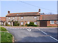
The property market in NR11 8NZ is heavily weighted toward owner-occupation. Seven out of every ten households own their homes, a figure of 76 per cent. This statistic fundamentally shapes the nature of the housing stock in this postcode. You will primarily find houses, which aligns with the high rate of ownership and the traditional character of the area. Rental market activity appears secondary to owner-occupier transactions based on these figures. Homes in NR11 8NZ cater to those seeking to purchase a permanent residence rather than a temporary let. The dominance of houses suggests a preference for larger properties or detached dwellings typical of family living. This low rental proportion means a vibrant leasehold market is unlikely to dominate the immediate streets. Buyers looking at this small area should expect competition from other purchasers rather than landlords seeking tenants. The accommodation type data confirms a market built for settlement. Propositions here appeal to individuals who wish to buy and stay. The market reflects a community where residents have chosen to root themselves locally. This stability influences property values and the availability of homes for sale.
House Prices in NR11 8NZ
Showing 3 properties
| Address | Type | Beds | Baths | Last Sale Price | Last Sale Date | |
|---|---|---|---|---|---|---|
| St James Barn, St James Court, Southrepps, NR11 8NZ | Semi-detached | 4 | - | - | - | |
| Lodge Barn, St James Court, Southrepps, NR11 8NZ | Detached | - | - | - | - | |
| Old Wall House, St James Court, Southrepps, NR11 8NZ | Detached | - | - | - | - |
Energy Efficiency in NR11 8NZ
Daily life in NR11 8NZ is supported by a selection of amenities within practical reach. Residents benefit from five nearby rail stations, including Gunton Railway Station, Roughton Road Railway Station, and Cromer Railway Station. These five stations provide commercial and residential connectivity beyond the immediate cluster. For daily necessities, there are five notable retail outlets available without requiring a long commute. You can find a Spar, Tesco Mundesley, and Waitrose North among these five key locations. These venues cover essential shopping needs from fresh groceries to household items. The area serves your practical requirements for food and daily consumption. While the residential cluster is small, the surrounding amenities ensure you do not need to travel far for basic provisions. The presence of these five retail options and five rail connections integrates NR11 8NZ into the wider regional economy. Lifestyle here balances the quiet of a small postcode with the convenience of nearby transport hubs and supermarkets. Your weekly shop could be at Tenso Mundesley or Waitrose North, both designated nearby points. Travel to wider destinations starts from one of the five accessible railway nodes.
Amenities
Schools
Families considering NR11 8NZ have access to two specific primary education options. The nearest provision is St. Mary's (Endowed) CofE VA Primary School, which serves the early educational needs of local children. A second option exists as St Mary's Church of England Primary Academy, offering an alternative primary education setting within reach. Both schools operate at the primary level, meaning no secondary schools are listed in the immediate proximity for this specific postcode. This configuration suggests that older children may need transportation to facilities further away or that the catchment area extends beyond the immediate cluster. You must ensure distance to these two institutions meets your transport requirements. The presence of two primary schools indicates a density of education provision relatively strong for this small residential cluster. Living in NR11 8NZ offers proximity to educational establishments where values and curricula align with Church of England traditions in both cases. The specific naming of these schools highlights the local integration of religious and state-maintained elements within the C of E education framework. School choices here are clearly focused on the primary stage of education for the local demographic.
| Rank | School | Type | Entry gender | Ages |
|---|
Explore more schools in this area
Go to Schools tabDemographics
The community in NR11 8NZ is defined by a mature resident base. The median age stands at 47 years, meaning half the population is over this age while half is under. Most commonly, the area is populated by adults between 30 and 64 years of age. This age profile suggests a neighbourhood stabilised by families and professionals who have established roots. Home ownership is the primary form of tenure, standing at a high 76 per cent of all households. Consequently, the area consists predominantly of houses rather than apartments or high-rise flats. This ownership level indicates long-term residents who have stayed through various market cycles. The predominant ethnic group is White, reflecting the demographic composition typical of established coastal and rural housing clusters. You will find a population that has settled for an extended period. The high ownership rate contributes to a stable community where younger families and established households coexist. living in NR11 8NZ involvesinteraction with people who have invested heavily in their local environment. The demographic data reflects a traditional housing market where ownership predates tenancy significantly.
Household Size
Accommodation Type
Tenure
Ethnic Group
Religion
Household Composition
Age
Household Deprivation
NS-SEC
Explore more demographic insights in this area
Go to Demographics tabPlanning
Planning Constraints
- Flood RiskPremium
- Ramsar Wetland SitesPremium
- Area of Outstanding Natural BeautyPremium
- Protected Nature ReservePremium
- Protected WoodlandPremium