Area Overview for NR11 8DG
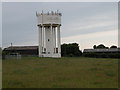
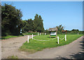
Photos of NR11 8DG


Area Information
The postcode NR11 8DG covers a compact residential cluster containing 1,426 people across a 4.5 hectare zone. This small footprint creates a tight-knit environment where neighbours know one another by sight. The area sits within the Broads region of Norfolk, England, and functions as a distinct pocket within the wider local network. Daily life here moves at a measured pace, removing the stress of large urban commutes while maintaining necessary connections to the outside world. You will find a static population that values stability over rapid change. The physical scale of NR11 8DG means that local streets are well known, and community events carry significant weight for residents. Prospective buyers considering homes in NR11 8DG should appreciate the clear boundaries of this settlement. The density stands at 838 people per square kilometre, which is moderate for a UK residential area. This figure suggests a balance between open space and convenience. You will not find the intense congestion of city centres, yet shops and services are close enough to reach without long journeys. The area offers a traditional English countryside living experience without complete isolation. For those seeking a small property search target with defined limits, this postcode delivers exactly that. It is a place where you can build a permanent home rather than just a temporary stopover.
- Area Type
- Postcode
- Area Size
- 4.5 hectares
- Population
- 1426
- Population Density
- 838 people/km²
The housing stock in NR11 8DG is defined by stability and traditional construction. With 75 per cent of residents owning their homes, this is not a rental market. You will not see high turnover tenancies or short-term lets dominating the local streets. Instead, the area functions as a stable community where families and retirees build roots over decades. The predominant accommodation type is houses, which means you will mostly encounter detached, semi-detached, or terrace homes rather than flats or purpose-built apartment blocks. This type of housing aligns perfectly with the area's older demographic. Buyers looking at properties in NR11 8DG should expect a market characterised by maturity. The high ownership rate suggests that when a property does come up for sale, it is often due to succession or life changes rather than simple market fluctuations. This creates a predictable environment for those wishing to purchase a family home or a retirement property. The area does not cater to the student rental sector or the transient professional crowd. If you are thinking about living in NR11 8DG, you are entering an owner-occupier zone where long-term value and local knowledge hold the most weight. The market moves slowly, and decisions are driven by need rather than speculation. You will find solid, traditional homes built to last, reflecting the lasting commitment of the people who live there.
House Prices in NR11 8DG
Showing 32 properties
| Address | Type | Beds | Baths | Last Sale Price | Last Sale Date | |
|---|---|---|---|---|---|---|
| 22, Siesta Mar Chalet Park, Gimingham Road, Mundesley, NR11 8DG | Bungalow | 2 | 1 | - | - | |
| 24, Siesta Mar Chalet Park, Gimingham Road, Mundesley, NR11 8DG | Bungalow | 2 | 1 | - | - | |
| 28, Siesta Mar Chalet Park, Gimingham Road, Mundesley, NR11 8DG | Bungalow | 2 | 1 | - | - | |
| 23, Siesta Mar Chalet Park, Gimingham Road, Mundesley, NR11 8DG | Bungalow | 2 | - | - | - | |
| 5, SIESTA MAR CHALET PARK, GIMINGHAM ROAD, Mundesley, NR11 8DG | Semi-detached | 2 | 1 | - | - | |
| The Hughes, Gimingham Road, Mundesley, NR11 8DG | Detached | - | - | - | - | |
| 25, Siesta Mar Chalet Park, Gimingham Road, Mundesley, NR11 8DG | Semi-detached | - | - | - | - | |
| 38, Siesta Mar Chalet Park, Gimingham Road, Mundesley, NR11 8DG | Semi-detached | - | - | - | - | |
| 16, Siesta Mar Chalet Park, Gimingham Road, Mundesley, NR11 8DG | Semi-detached | - | - | - | - | |
| 1, Siesta Mar Chalet Park, Gimingham Road, Mundesley, NR11 8DG | Semi-detached | - | - | - | - |
Energy Efficiency in NR11 8DG
Life in NR11 8DG revolves around practical travel to support daily needs. You will find five notable retail venues within practical reach of the residential cluster. These include a Tesco Mundesley, a Sainsburys North, and a Waitrose North. These supermarkets provide the essential groceries and household goods you need. For residents of NR11 8DG, there is no need to drive far to eat or shop. The concentration of these three major retailers ensures that your weekly shop is never far from home. Transport links extend via three railway stations within reasonable distance. The Gunton Railway Station, North Walsham Railway Station, and Roughton Road Railway Station offer rail access for those wishing to commute or travel. These stations connect the local community to broader networks in Great Yarmouth and Norwich. You do not live in Isolation, yet you do not face the noise and pollution of a mainline corridor. The lifestyle here is one of convenient access. You can walk to your local Tesco or drive quickly to North Walsham for a larger range of options. This balance of local convenience and regional access defines the daily rhythm of life in this specific postcode. The presence of Waitrose specifically adds a layer of quality retail choice to the immediate surroundings.
Amenities
Schools
| Rank | School | Type | Entry gender | Ages |
|---|
Explore more schools in this area
Go to Schools tabDemographics
The community profile in NR11 8DG reflects a settled, older population. The median age sits at 47 years, which is higher than the national average for many English districts. Data confirms that the largest concentration of residents falls into the elderly group, aged 65 years and over. This demographic skew indicates a strong presence of retirees and older homeowners who have stayed through the decades. You are unlikely to hear chaotic household arguments or see young families rushing to school gates in the early mornings unless there is a specific primary school nearby. Home ownership in NR11 8DG reaches 75 per cent of all households. This high figure points to an area where people stay for the long term rather than renting for short spells. The dominant accommodation type is houses, not flats or apartments. This physical reality aligns with the age profile, as larger family homes often appeal to retirees seeking space and silence. The predominant ethnic group is White, which forms the vast majority of the local registration data. There is no significant minority population recorded in this specific postcode. The social fabric is traditional and stable, driven by long-term residency rather than transient labour. You will find a quiet neighbourhood where security and routine form the basis of daily social interaction.
Household Size
Accommodation Type
Tenure
Ethnic Group
Religion
Household Composition
Age
Household Deprivation
NS-SEC
Explore more demographic insights in this area
Go to Demographics tabPlanning
Planning Constraints
- Flood RiskPremium
- Ramsar Wetland SitesPremium
- Area of Outstanding Natural BeautyPremium
- Protected Nature ReservePremium
- Protected WoodlandPremium