Area Overview for NR10 5QD
Photos of NR10 5QD
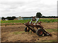
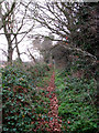
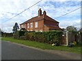
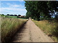
10 photos from this area
Area Information
Key information about the NR10 5QD including its size, population, and administrative classification.
- Area Type
- Postcode
- Area Size
- 27.0 hectares
- Population
- 1598
- Population Density
- 75 people/km²
House Prices in NR10 5QD
11
Properties
£345,000
Average Sold Price
£290,000
Lowest Price
£400,000
Highest Price
Showing 11 properties
| Address | Type | Beds | Baths | Last Sale Price | Last Sale Date | |
|---|---|---|---|---|---|---|
| Rowan Cottage, Little London Lane, Marsham, NR10 5QD | Detached | - | - | £400,000 | Oct 2020 | |
| Coverdale House, Little London Lane, Marsham, NR10 5QD | Detached | - | - | £290,000 | Jul 2004 | |
| Lake Vue, 72 High Street, Marsham, NR10 5QD | Bungalow | 3 | - | - | - | |
| Coverdale Lodge, 76 High Street, Marsham, NR10 5QD | Detached | - | - | - | - | |
| Sunny Lake, 70 High Street, Marsham, NR10 5QD | Detached | - | - | - | - | |
| Lamberts Farm, 65 High Street, Marsham, NR10 5QD | Semi-detached | - | - | - | - | |
| Heath House, 74 High Street, Marsham, NR10 5QD | Detached | - | - | - | - | |
| Fairview, 67 High Street, Marsham, NR10 5QD | house | - | - | - | - | |
| Little London Farmhouse, Little London Lane, Marsham, NR10 5QD | house | - | - | - | - | |
| Little London Farm, High Street, Marsham, NR10 5QD | Detached | - | - | - | - |
Page 1 of 2
Energy Efficiency in NR10 5QD
Amenities
Schools
| Rank | School | Type | Entry gender | Ages |
|---|
Explore more schools in this area
Go to Schools tabDemographics
Household Size
Two person
most common
Accommodation Type
Houses
most common
Tenure
77
majority
Ethnic Group
White
most common
Religion
N/A
most common
Household Composition
N/A
most common
Age
47
median
Adults (30-64 years)
most common
Household Deprivation
N/A
with no deprivation
NS-SEC
33
in Lower managerial occupations
Explore more demographic insights in this area
Go to Demographics tabPlanning
Planning Constraints
- Flood RiskPremium
- Ramsar Wetland SitesPremium
- Area of Outstanding Natural BeautyPremium
- Protected Nature ReservePremium
- Protected WoodlandPremium