Area Overview for NR10 4TD
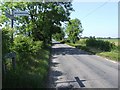
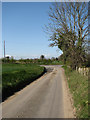
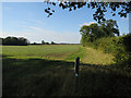
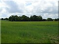
Photos of NR10 4TD

Area Information
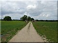
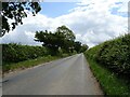
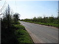
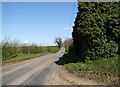
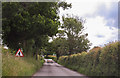
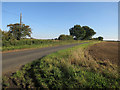
NR10 4TD represents a small, quiet residential cluster situated within the broader context of the Norfolk coast. This specific postcode covers an area of just 13.9 hectares, creating a distinctly intimate living environment. With a population of 1,259 people, the community feels close-knit rather than sprawling. You are looking at a neighbourhood where the pace of life is dictated by local rhythms rather than urban commuter pressures. The density is moderate at 29 people per square kilometre, ensuring that you will not find the noise and congestion associated with larger towns. Living in NR10 4TD means prioritising space and stillness over the immediate throng of a city centre. The total population suggests a stable community where neighbours often know one another by sight. This postcode serves as a snapshot of a specific slice of rural life, offering a defined boundary for residents while maintaining connections to the wider region. For those considering this area, it offers a grounded experience defined by its modest scale and clear residential focus.
- Area Type
- Postcode
- Area Size
- 13.9 hectares
- Population
- 1259
- Population Density
- 29 people/km²
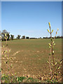
The property market within NR10 4TD is defined by a strong preference for ownership and substantial dwelling types. You will find that 75% of the stock is composed of owner-occupied homes. This statistic signals a marketplace driven by buyers rather than landlords, suggesting properties are often held across multiple generations. The accommodation type data confirms that houses make up nearly the entirety of the local housing stock. You will rarely encounter flats or high-density blocks in this specific postcode. This environment suits those seeking traditional living spaces with separate gardens and private entrances. The low density and house-focused inventory mean you are looking at classic suburban or rural living arrangements. For prospective buyers, this area presents as a stable market without the volatility often seen in purely investment-led pockets. The sheer size of the area at 13.9 hectares further indicates that properties offer meaningful land plots rather than constrained city lots.
House Prices in NR10 4TD
Showing 2 properties
| Address | Type | Beds | Baths | Last Sale Price | Last Sale Date | |
|---|---|---|---|---|---|---|
| Eves Hill Farmhouse, Norwich Road, Booton, NR10 4TD | house | - | - | - | - | |
| Eves Hill Farm Camping And Farm Shop, Eves Hill Farm, Norwich Road, Booton, NR10 4TD | shop | - | - | - | - |
Energy Efficiency in NR10 4TD
Daily life in NR10 4TD relies on a straightforward network of local amenities within practical reach. You have access to five main retail outlets, including a Spar, a Co-op in Reepham, and a Budgens in Lenwade. These shops form the primary hub for groceries and general requirements. For those requiring rail travel or bus services, there is one metro station located in Aylsham. This station provides the main link for residents wishing to travel further afield. The amenities are functional and directly serve the residential need, without the distraction of a large commercial district. Your daily errands can be completed using these specific local providers, keeping trips short and efficient. The limited but dedicated retail base ensures you do not have to travel far for essential items, supporting the quiet character of the 13.9-hectare zone.
Amenities
Schools
| Rank | School | Type | Entry gender | Ages |
|---|
Explore more schools in this area
Go to Schools tabDemographics
The community profile in NR10 4TD reflects a mature, established population. The median age is 47 years, indicating that a significant portion of residents are in their middle years. Adults between the ages of 30 and 64 form the most common age range in this neighbouring area. This demographic skew suggests the location attracts families and individuals seeking stability over the transient nature of student or early-career hubs. Home ownership is a dominant feature of local housing, with 75% of residents owning their homes outright or with a mortgage. This high rate points to long-term settlement patterns rather than a fluctuating rental market. The prevailing accommodation type consists of houses, reinforcing the character of the suburb as a family-oriented zone. Census data also shows that the predominant ethnic group is White, aligning with the traditional demographic makeup of much of the region. These figures combine to create a picture of a settled community where residents are likely invested in the local area for the foreseeable future.
Household Size
Accommodation Type
Tenure
Ethnic Group
Religion
Household Composition
Age
Household Deprivation
NS-SEC
Explore more demographic insights in this area
Go to Demographics tabPlanning
Planning Constraints
- Flood RiskPremium
- Ramsar Wetland SitesPremium
- Area of Outstanding Natural BeautyPremium
- Protected Nature ReservePremium
- Protected WoodlandPremium