Area Overview for NR10 4RP
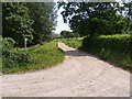
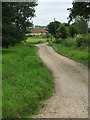
Photos of NR10 4RP


Area Information
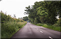
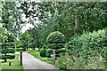
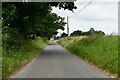
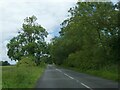
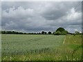
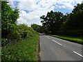
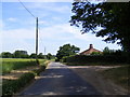
Living in NR10 4RP offers a distinct residential experience characterised by a low-density, suburban environment. This postcode covers a specific residential cluster spanning 75.1 hectares, hosting a manageable population of 1,376 people. You will encounter a quiet setting with a density of 80 people per square kilometre. This spacing defines the daily rhythm of the area, where streets resemble those found in village green-surrounded settlements rather than busy urban centres. The layout of this neighbourhood supports a lifestyle focused on local convenience and access to nearby facilities without the noise of major transport corridors. You are part of a small community where houses sit relatively close to one another yet maintain independent gardens and courtyards. The area feels established, with 1,376 individuals calling this specific cluster home. For families and professionals seeking a break from congestion, NR10 4RP provides a peaceful footprint. You benefit from a sizeable expanse of land within a defined postcode boundary. This space allows for local leisure activities within the immediate vicinity. The 75.1 hectare size ensures that there is room for the houses to breathe while remaining accessible to the wider region. This balance of space and community makes the postcode a practical choice for those who value a home environment over city centre immediacy. When you move into NR10 4RP, you secure a position in a quiet, densely manageable zone that prioritises residential calm.
- Area Type
- Postcode
- Area Size
- 75.1 hectares
- Population
- 1376
- Population Density
- 80 people/km²
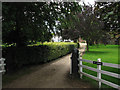
The housing market in NR10 4RP is dominated by owner-occupied properties. With 64 per cent of households classified as homeowners, you will find that developers and rental agencies have limited influence over this specific postcode. The physical stock consists almost entirely of houses. There are no purpose-built flats or high-density apartments recorded in the data for this area. This makes NR10 4RP a traditional family environment rather than a multi-generational student housing zone. When searching for homes in NR10 4RP, you should expect a variation in property ages and architectural styles typical of the region. The high ownership percentage suggests that selling this postcode often requires finding a buyer with significant capital, as sellers are invested in their long-term value. The market is not driven by short-term rental yields or tourism. Families looking for stability will find this area attractive due to the lack of transient workers. The predominance of houses means that external noise and visual impact are generally controlled by distance between dwellings. You will not find converting national rent-to-own schemes here. Instead, the market operates on traditional valuation metrics relevant to long-term families. For those buying, the environment supports private gardens and driveways, features often missing in high-density urban zones. This stability supports property values over time while ensuring a consistent residential character.
House Prices in NR10 4RP
Showing 8 properties
| Address | Type | Beds | Baths | Last Sale Price | Last Sale Date | |
|---|---|---|---|---|---|---|
| Malkin House, Reepham Road, Kerdiston, NR10 4RP | Detached | - | - | £249,000 | May 2003 | |
| Gooseacre, Reepham Road, Kerdiston, NR10 4RP | Detached | - | - | - | - | |
| Old Oaks Barn, Reepham Road, Kerdiston, NR10 4RP | house | - | - | - | - | |
| Oaks Farm Cottage, Reepham Road, Kerdiston, NR10 4RP | Detached | - | - | - | - | |
| Quercus Cottage, Reepham Road, Kerdiston, NR10 4RP | Detached | - | - | - | - | |
| Old Oaks Hall, Reepham Road, Kerdiston, NR10 4RP | house | - | - | - | - | |
| Kerdiston House Farm, Reepham Road, Kerdiston, NR10 4RP | Detached | - | - | - | - | |
| Owls Oak, Reepham Road, Kerdiston, NR10 4RP | Semi-detached | - | - | - | - |
Energy Efficiency in NR10 4RP
Your day-to-day convenience in NR10 4RP hinges on a cluster of five retail venues within practical reach. You can buy groceries and essentials at Morrisons Daily, Spar, and Co-op Reepham. These specific shops form the backbone of the local High Street or village centre experience. No major supermarkets or hypermarkets exist within the immediate data scope, meaning trips outside the local area are required for larger shopping carts or bulk buying. You will find that daily necessities are accessible without long drives. The presence of Spar and Co-op ensures that opening hours often extend into the evening, providing flexibility for working parents. Five retail outlets offer a satisfying mix of daily goods, from fresh produce to household essentials. The area lacks a listed cinema, gym, or park in the immediate data, focusing the lifestyle on retail and home-based activities. The lifestyle here is defined by self-sufficiency and neighbourhood interaction. Residents rely on these local stores for most consumer needs. The proximity of Morrisons and the Co-op stores to the residential cluster ensures that your weekly shop is nearby. This retail density supports a sustainable way of living where short car journeys are sufficient. Living in NR10 4RP means your daily errands stay local, supported by the named shops identified in this area.
Amenities
Schools
Families considering NR10 4RP will find two primary educational institutions nearby. Reepham Primary School operates as a primary school with a good Ofsted rating. This facility serves the younger demographic in the neighbourhood. Reepham High School and College also serves as a primary school, holding a good Ofsted rating alongside its academy status. The presence of both a primary school and an academy indicates a robust educational framework within reach. The schools listed are key anchors for the local community. You do not need to travel far to access a qualified educational space. The Ofsted rating of good for both institutions signals quality teaching standards and safe environments for children. Living in NR10 4RP places you in a catchment area where the state education system is actively monitored and rated positively. You can access these specific schools without crossing significant administrative boundaries. For parents, the mix of school types offers flexibility while maintaining high standards. Reepham Primary School focuses on early learning, while Reepham High School and College provides broader academic pathways. The proximity of these venues to the postcode ensures that daily drop-offs and pick-ups are manageable. Schools near NR10 4RP represent a solid foundation for your child's education. The reputations of these schools contribute directly to the desirability of the homes in this area.
| Rank | School | Type | Entry gender | Ages |
|---|
Explore more schools in this area
Go to Schools tabDemographics
The community within NR10 4RP reflects a mature and stable society. The median age stands at 47 years, indicating that families with older children or retired residents form the core of the population. Most inhabitants fall into the adult age range of 30 to 64 years. This demographic concentration suggests a neighbourhood of established homeowners rather than young renters or students. You are entering a society where residents have likely grown up or settled in their current dwellings. Homeownership is a defining feature of this locality, with 64 per cent of households owning their homes outright or with a mortgage. This high rate of ownership typically correlates with lower crime rates and greater investment in property maintenance. The accommodation stock is exclusively houses, offering detached, semi-detached, and terraced options suited to family life. The predominant ethnic group is White, contributing to the area's long-standing residential character. Your neighbours are likely active contributors to the local environment, preferring the security of tenure that comes with owning a house. The age profile means that councils and local groups often cater to the needs of working families and empty-nesters. Living in NR10 4RP means joining a community with clear economic stability. The lack of student housing or transient rental accomodation reinforces the picture of a permanent, roots-focused population.
Household Size
Accommodation Type
Tenure
Ethnic Group
Religion
Household Composition
Age
Household Deprivation
NS-SEC
Explore more demographic insights in this area
Go to Demographics tabPlanning
Planning Constraints
- Flood RiskPremium
- Ramsar Wetland SitesPremium
- Area of Outstanding Natural BeautyPremium
- Protected Nature ReservePremium
- Protected WoodlandPremium