Area Overview for NR10 4RD
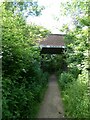
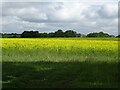
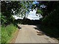
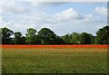
Photos of NR10 4RD


Area Information
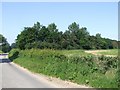
NR10 4RD is a defined postcode covering a small residential cluster within England. This specific area spans 27.1 hectares, containing a population of 1,259 residents. The low population density of 29 people per square kilometre indicates a spacious, spread-out character where neighbours are rarely next-door neighbours in the traditional sense. Living in this locality means navigating a neighbourhood designed for quiet dispersion rather than dense urban interaction. The environment prioritises room and separation, which suits those who value privacy and a slower pace of life. You will find that daily routines in NR10 4RD are shaped by proximity to immediate local services rather than the high-energy pulse of a town centre. The set of 1,259 households forms a compact, self-contained community that balances independence with local connectivity. This layout appeals to buyers seeking homes in an area that feels exclusive through its scarcity of houses rather than official restrictions. The physical spread over nearly 28 hectares ensures that the built environment does not dominate the landscape. Prospective buyers looking for a legitimate residential address with clear boundaries will find their requirements met here without the clutter of surrounding development.
- Area Type
- Postcode
- Area Size
- 27.1 hectares
- Population
- 1259
- Population Density
- 29 people/km²
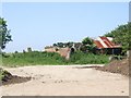
Homes in NR10 4RD form a market defined by stability and high ownership rates. You can expect that 75% of the residential stock consists of owner-occupied properties, leaving only a quarter of homes for rental purposes. This market dynamic distinguishes the area as a place where families settle to build long-term roots rather than treating housing as a temporary asset. The accommodation type is exclusively houses, meaning there are no flats to consider within this specific postcode cluster. This absence of multi-unit dwellings means the visual character is uniform, with private gardens and detached or semi-detached structures defining the streetscape. For anyone hunting for homes in NR10 4RD, the selection will involve traditional architecture suited to local planning constraints. The high ownership percentage implies that houses here have seen multiple renovations and modifications, adding a layer of improvement to the existing structure. Buyers looking for rental income opportunities will find limited stock, as the market is saturated with homeowners who have already secured their primary residences. The distinction between owning and renting is stark, with owner-occupiers virtue-signalling through their commitment to the property. This creates a stable environment for sellers who can command prices based on long-term investment rather than speculative trends.
House Prices in NR10 4RD
Showing 7 properties
| Address | Type | Beds | Baths | Last Sale Price | Last Sale Date | |
|---|---|---|---|---|---|---|
| Malthouse Cottage, Mill Road, Reepham, NR10 4RD | house | - | - | £535,000 | Nov 2019 | |
| Malthouse Farm, Mill Road, Reepham, NR10 4RD | Detached | 4 | 2 | £460,000 | Feb 2015 | |
| Malthouse Barn, Mill Road, Reepham, NR10 4RD | house | - | - | £207,500 | Feb 2004 | |
| The Malthouse, Mill Road, Reepham, NR10 4RD | Detached | - | - | - | - | |
| 2, Mill Farm Cottages, Mill Road, Reepham, NR10 4RD | house | 3 | - | - | - | |
| 1, Mill Farm Cottages, Mill Road, Reepham, NR10 4RD | house | - | - | - | - | |
| Mill Farm, Mill Road, Reepham, NR10 4RD | Detached | - | - | - | - |
Energy Efficiency in NR10 4RD
Daily life in NR10 4RD revolves around a handful of essential services located within practical reach. Retail options include three supermarkets, specifically Spar, Co-op Reepham, and Budgens Lenwade. These three venues form the core of daily shopping, handling everything from fresh groceries to household essentials. Living in this area means you will walk or drive a short distance to secure your weekly food shop without needing to vent into larger towns. The presence of these three specific retailers reduces the need for online grocery subscriptions, which might otherwise compensate for the lack of immediate convenience stores. While there are only five retail outlets identified in the nearby amenities category, this consolidation allows for sufficient variety in pricing and product range. There are no dedicated leisure parks or leisure centres listed in the immediate vicinity, which defines the character of a purely residential zone focused on home-based activities. The simplicity of the amenity list implies that residents rely on cars for trips further than the local supermarket. Despite the limited retail footprint, the three named stores provide enough variety to sustain a typical household's routine needs without excessive travel time.
Amenities
Schools
| Rank | School | Type | Entry gender | Ages |
|---|
Explore more schools in this area
Go to Schools tabDemographics
The community within NR10 4RD reflects a mature population structure centred on established families. The median age stands at 47 years, confirming that the area is dominated by adults aged between 30 and 64. This age range indicates a workforce that is likely settled and financially independent, making the location attractive for those seeking stability. Home ownership is exceptionally high at 75%, demonstrating that the majority of residents are long-term owners rather than tenants. This figure suggests financial security among locals who prioritised buying a home early in their adult lives. Houses remain the predominant accommodation type, consistent with the preference for ownership and the established nature of the demographic. The resident population is predominantly White, aligning with the broader characteristics of the surrounding regions in this part of England. With three-quarters of households representing owners, the social fabric relies heavily on established roots rather than transient renting. Residents are likely digging gardens rather than playing them, reflecting a lifestyle where property improvements are a common priority. The demographic profile points to a community that values permanence over mobility.
Household Size
Accommodation Type
Tenure
Ethnic Group
Religion
Household Composition
Age
Household Deprivation
NS-SEC
Explore more demographic insights in this area
Go to Demographics tabPlanning
Planning Constraints
- Flood RiskPremium
- Ramsar Wetland SitesPremium
- Area of Outstanding Natural BeautyPremium
- Protected Nature ReservePremium
- Protected WoodlandPremium