Area Overview for NR10 4PG
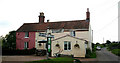
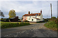
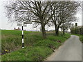
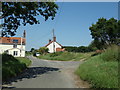
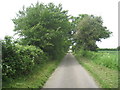
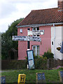
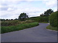
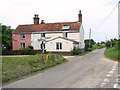
Photos of NR10 4PG
Area Information
Buying a home in NR10 4PG means settling into a small, defined residential cluster located in Norfolk, England. This specific postcode occupies an area of 27.2 hectares and is home to 1,259 people. With a population density of just 29 people per square kilometre, life here unfolds at a slower pace than dense urban centres. You are living in a space where residents have plenty of room while remaining close to the local high street and key services. The area functions as a quiet residential pocket rather than a commercial hub, offering a distinct lifestyle away from the noise of larger towns. Those considering homes in this sector value the balance between proximity to amenities and the peace of a low-density environment. The community is tight-knit, defined by its manageable size and clear boundaries. When you choose NR10 4PG, you select a neighbourhood characterised by its specific metrics of low density and concentrated housing. It is a practical choice for buyers who prioritise a tranquil setting near Aylsham without sacrificing access to daily necessities. The landscape is distinctly rural, shaped by the small footprint of the residential cluster rather than expansive development zones.
- Area Type
- Postcode
- Area Size
- 27.2 hectares
- Population
- 1259
- Population Density
- 29 people/km²
The housing market in NR10 4PG mirrors the area's residential nature and specific stock composition. Buyers looking at homes in this sector will find a diverse range of property types, including detached, semi-detached, terraced, and apartment styles. This variety appeals to different budget ranges and personal preferences within a confined 27.2-hectare boundary. The area comprises a total of 538 households, suggesting a stable mix of residents who have established roots in these specific properties. While exact sale prices are not provided for this small cluster, the mix of accommodation types implies a competitive market for suitable properties. The presence of both flats and houses indicates that the area caters to various living arrangements, from young professionals in smaller units to families seeking more space. Understanding the local property stock is essential when comparing NR10 4PG against neighbouring postcodes. The density of 29 people per square kilometre suggests that any available land for new development is strictly limited, potentially affecting future housing supply. Prospective buyers should consider the age of the existing stock, as older properties are common in established rural clusters. The market dynamics here are likely driven by demand from those seeking quiet, affordable housing near Aylsham rather than speculative investment from high-volume developers.
House Prices in NR10 4PG
Showing 4 properties
| Address | Type | Beds | Baths | Last Sale Price | Last Sale Date | |
|---|---|---|---|---|---|---|
| The Cottage, Cawston Road, Brandiston, NR10 4PG | Cottage | 3 | 2 | £296,500 | Apr 2018 | |
| Tubby, Cawston Road, Brandiston, NR10 4PG | Cottage | 2 | 1 | - | - | |
| Primrose Cottage, Cawston Road, Brandiston, NR10 4PG | house | 4 | 1 | - | - | |
| Rivett, Cawston Road, Brandiston, NR10 4PG | Semi-detached | - | - | - | - |
Energy Efficiency in NR10 4PG
Daily life in NR10 4PG centres on practical convenience and proximity to local high streets. You will find five main retail outlets within easy reach of the postcode, ensuring your weekly shopping needs are met without a long drive. Key venues include Spar, Co-op Reepham, and Budgens Lenwade, which provide comprehensive grocery and daily essentials. These shops are located in surrounding areas that are practically accessible to residents of NR10 4PG. For those who enjoy shopping trips further afield, the metro station in Aylsham serves as a transport and leisure hub just nearby. This one metro location offers connections beyond the immediate rural setting, linking you to wider retail and entertainment districts. The lifestyle here balances rural quiet with the ability to reach services quickly. You do not need to travel far to find breakfast, fuel, or household goods. The small area size of 27.2 hectares means most essential amenities are a short drive away at most. This setup is ideal for families or retirees who value independence but dislike the isolation of remote locations. Whether you prefer picking up fresh produce at Budgens or grabbing coffee near Reepham, the layout of NR10 4PG supports an active, convenient routine.
Amenities
Schools
| Rank | School | Type | Entry gender | Ages |
|---|
Explore more schools in this area
Go to Schools tabDemographics
The community within NR10 4PG reflects the area's modest scale and rural setting. With a total population of 1,259 residents spread across 27.2 hectares, the area maintains a very low density of 29 people per square kilometre. This figure suggests a neighbourhood where households often enjoy significant privacy and quiet surroundings. The demographic profile is typical of a small cluster in this part of Norfolk, hosting families, retirees, and commuters who prefer a slower lifestyle. There are 538 households registered within this postcode, which equates to an average household size of approximately 2.34 people. This number indicates a mix of couples living together and families, with fewer instances of large extended households or single-person homes. The accommodation types are predominantly residential flats alongside detached homes, single detached, single attached, terraced, and semi-detached properties. This variety offers buyers different structural options within a single postcode zone. The low population density directly influences the social fabric, creating a community where neighbours are often within hearing distance. For those researching schools near NR10 4PG, the primary options lie just beyond the immediate boundary, consistent with the area's residential focus rather than institutional concentration.
Household Size
Accommodation Type
Tenure
Ethnic Group
Religion
Household Composition
Age
Household Deprivation
NS-SEC
Explore more demographic insights in this area
Go to Demographics tabPlanning
Planning Constraints
- Flood RiskPremium
- Ramsar Wetland SitesPremium
- Area of Outstanding Natural BeautyPremium
- Protected Nature ReservePremium
- Protected WoodlandPremium