Area Overview for NR10 4LS
Photos of NR10 4LS

Area Information
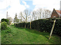
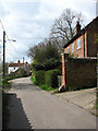
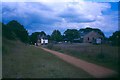
NR10 4LS is a small residential cluster in Norfolk that covers just 4.2 hectares. With a population of 1283 people, the area is intimate and locally focused. You will find a community where neighbours likely know each other, given the compact geography. This postcode serves as a specific hub for families and established residents within the broader Norfolk landscape. The low density of 670 people per square kilometre means plenty of green space surrounds individual properties. Life here revolves around the quiet character of the village rather than the noise of a busy town centre. You can walk to local shops and rely on specific transport links without feeling trapped in isolation. The area offers a grounded way of living where the scale of your neighbourhood remains manageable. Residents appreciate the clear distinction between having access to necessary facilities while maintaining a peaceful domestic environment. This location suits those who value simplicity and a non-commercial pace of life.
- Area Type
- Postcode
- Area Size
- 4.2 hectares
- Population
- 1283
- Population Density
- 670 people/km²
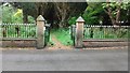
Homes in NR10 4LS are primarily houses, reflecting the agricultural and historical nature of the postcode district. The market here is overwhelmingly owner-occupied, with 81 per cent of residents holding their own property title. You will struggle to find large communities of tenant households in this specific cluster. This high ownership rate means properties tend to be tended to carefully and sold only when owners wish to move. The housing stock is designed for families and couples rather than corporate tenancies or student lettings. When you look at the area, you see permanent structures established generations ago rather than speculative developments. Buyers looking for rental investment opportunities will find fewer openings than those seeking a family home on a mortgage. The low density of 670 people per square kilometre limits the total number of available properties on the market. Prospective buyers must act quickly when suitable homes appear, as the supply chain in a 4.2 hectare zone is inherently tight.
House Prices in NR10 4LS
Showing 69 properties
| Address | Type | Beds | Baths | Last Sale Price | Last Sale Date | |
|---|---|---|---|---|---|---|
| 22 Richmond Rise, Reepham, NR10 4LS | Bungalow | 3 | 1 | £288,000 | Nov 2024 | |
| 37 Richmond Rise, Reepham, NR10 4LS | Bungalow | - | - | £270,000 | Jul 2023 | |
| 6 Richmond Rise, Reepham, NR10 4LS | Bungalow | 3 | 1 | £252,000 | Apr 2023 | |
| 28 Richmond Rise, Reepham, NR10 4LS | house | - | - | £200,000 | Nov 2022 | |
| 47 Richmond Rise, Reepham, NR10 4LS | Bungalow | - | - | £240,000 | Jul 2022 | |
| 36 Richmond Rise, Reepham, NR10 4LS | Detached | 2 | 1 | £237,500 | Apr 2022 | |
| 62 Richmond Rise, Reepham, NR10 4LS | Bungalow | - | - | £240,000 | Nov 2021 | |
| 8 Richmond Rise, Reepham, NR10 4LS | Semi-detached | 2 | - | £231,000 | Aug 2021 | |
| Journeys End, 64 Richmond Rise, Reepham, NR10 4LS | Bungalow | - | - | £257,000 | Jul 2021 | |
| 66 Richmond Rise, Reepham, NR10 4LS | Bungalow | 2 | 1 | £215,000 | Nov 2019 |
Energy Efficiency in NR10 4LS
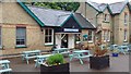
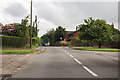
Daily life in NR10 4LS involves short trips to key amenities located within practical reach. You have five distinct retail outlets nearby, including the Co-op Reepham, a Spar in Lenwade, and Sudbrook Budgens. These shops handle your everyday essentials without requiring a journey to a major town. For those needing public transport, the town of Aylsham sits one metro station away. This makes commuting to larger centres feasible for work or leisure activities. The area lacks a large shopping centre, so you must make planned trips for bigger purchases. Dining options are limited to what these few shops provide, so you will cook most meals at home. The character of the lifestyle is defined by self-reliance and the convenience of local high street stops. You own your home in a quiet setting but drive or take a short bus ride for everything else. This balance suits those who do not require urban density for their daily routine.
Amenities
Schools
| Rank | School | Type | Entry gender | Ages |
|---|
Explore more schools in this area
Go to Schools tabDemographics
The community in NR10 4LS reflects a mature population with a median age of 47 years. Most residents fall into the adult bracket between 30 and 64 years old. This age profile suggests a neighbourhood built for stability rather than rapid change. Over 81 per cent of households own their homes outright or have a significant mortgage, indicating a settled community. The predominant ethnic group is White, aligning with the typical demographic make-up of rural Norfolk. Housing stock consists almost entirely of houses, with flats being rare or non-existent in this specific cluster. You will not find large private rental blocks here; instead, accommodation is permanently attached to the land. There are no specific deprivation metrics available in the provided records, but the high ownership rate generally correlates with financial stability among residents. Families and long-term couples likely dominate the street scenes, creating a consistent social fabric. The demographic reality points to an area where people plan to stay for the long term.
Household Size
Accommodation Type
Tenure
Ethnic Group
Religion
Household Composition
Age
Household Deprivation
NS-SEC
Explore more demographic insights in this area
Go to Demographics tabPlanning
Planning Constraints
- Flood RiskPremium
- Ramsar Wetland SitesPremium
- Area of Outstanding Natural BeautyPremium
- Protected Nature ReservePremium
- Protected WoodlandPremium