Area Overview for NR10 3NQ
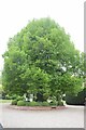
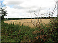
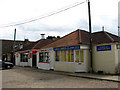
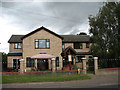
Photos of NR10 3NQ

Area Information
NR10 3NQ is a compact residential cluster covering just 1.7 hectares and home to 1,131 people. This small postcode represents a tightly knit neighbourhood where residents enjoy close proximity to their neighbours. The area is entirely housed, meaning you will find no flats or apartments within these boundaries. Daily life here revolves around a stable population that has supported this community for generations. You are looking at a zone with a population density of 66,191 people per square kilometre, which suggests a somewhat concentrated living environment despite the small physical footprint. Living in NR10 3NQ means embracing a lifestyle defined by exclusivity and proximity. Homes in this area are situated in a field of houses rather than a high-density urban block. This layout creates a quiet domestic setting where the focus remains on the house and the immediate garden space. The area's classification as a specific postcode sector ensures that you are examining a very defined slice of property. There is no room for expansion here, reinforcing the character of this established residential pocket. For those considering NR10 3NQ, the appeal lies in its simplicity and defined boundaries. You get a clear picture of what you are buying: a small, well-defined residential zone with a single dominant housing type and a known population size.
- Area Type
- Postcode
- Area Size
- 1.7 hectares
- Population
- 1131
- Population Density
- 3271 people/km²
The housing stock in NR10 3NQ is defined by a single, dominant accommodation type: houses. This lack of variety means you will not find flats, maisonettes, or apartments within this specific postcode sector. The market is heavily skewed towards owner-occupation, with a striking 86 per cent of households owning their homes. This high percentage indicates that NR10 3NQ is a deeply established community where residents have built long-term ties to their properties. You are unlikely to find a transient rental population fluctuating through the streets. The market therefore operates on the sale and purchase of existing homes rather than new-build developments or leases. This creates a stabilising effect on local property values, as the primary motivation for selling is often relocation rather than a move to a rental. Buying a property here means acquiring a house in an area where the majority of neighbours are also homeowners. This contrasts sharply with mixed housing estates where social capital is often different. The concentration of houses and high ownership rates suggests that homes in NR10 3NQ are likely to appeal to buyers seeking a traditional, owner-occupier lifestyle. There is no split market here, just a consistent demand for houses among a stable population. Your search for a property in this zone should focus entirely on the single-type housing stock available.
House Prices in NR10 3NQ
Showing 18 properties
| Address | Type | Beds | Baths | Last Sale Price | Last Sale Date | |
|---|---|---|---|---|---|---|
| 135 Crostwick Lane, Spixworth, NR10 3NQ | Bungalow | 3 | 1 | £380,000 | Mar 2024 | |
| 143 Crostwick Lane, Spixworth, NR10 3NQ | Semi-detached | 5 | - | £250,000 | Mar 2015 | |
| 102A Crostwick Lane, Spixworth, NR10 3NQ | Bungalow | 4 | 1 | £130,000 | Jan 2015 | |
| 112 Crostwick Lane, Spixworth, NR10 3NQ | Bungalow | - | - | £129,500 | Jun 2010 | |
| 106A Crostwick Lane, Spixworth, NR10 3NQ | Detached | 4 | 2 | £210,000 | Mar 2008 | |
| 141 Crostwick Lane, Spixworth, NR10 3NQ | Semi-detached | - | - | £224,950 | Mar 2007 | |
| 108 Crostwick Lane, Spixworth, NR10 3NQ | Detached | - | - | £185,000 | Jul 2004 | |
| 137 Crostwick Lane, Spixworth, NR10 3NQ | Semi-detached | - | - | £57,750 | Mar 1997 | |
| Rooms 1 And 2, Spixworth Motel, 145 Crostwick Lane, Spixworth, NR10 3NQ | Detached | 3 | 2 | - | - | |
| Room 23, Spixworth Motel, 145 Crostwick Lane, Spixworth, NR10 3NQ | Detached | 4 | 1 | - | - |
Energy Efficiency in NR10 3NQ
Daily life in NR10 3NQ offers practical access to a range of essential amenities within easy reach. You have five notable retail options nearby, including the East of England Co-operative Co, Morrisons Old, and Lidl Sprowston. These shops provide your weekly groceries and household essentials without requiring long drives. For air travellers, Norwich International Airport is accessible, though it sits outside the immediate residential zone. Commuters can utilise four railway stations for travel, with Salhouse Railway Station, Hoveton & Wroxham Railway Station, and Norwich Railway Station being the key hubs. Wroxham is also referenced as a metro point, suggesting wider transport links beyond the standard rail network. Living in NR10 3NQ means you do not need a car for every grocery run or basic shopping trip. The presence of Morrisons Old and Lidl Sprowston guarantees that fresh food is a short drive or walk away depending on your car. Rail connectivity via Salhouse and Hoveton & Wroxham offers a direct link to Norwich and beyond. This combination of retail variety and rail access defines the convenience of the location. Homes in NR10 3NQ are positioned to take advantage of these nearby services while retaining their residential character.
Amenities
Schools
| Rank | School | Type | Entry gender | Ages |
|---|
Explore more schools in this area
Go to Schools tabDemographics
The community in NR10 3NQ reflects a mature demographic profile with a median age of 47 years. Adults between the ages of 30 and 64 constitute the most common age range, creating a settled population base dominated by working families and established individuals. High home ownership levels confirm this stability, with 86 per cent of residents owning their property outright. This statistic highlights that the neighbourhood functions primarily as an owner-occupier market rather than a rental sector. You will encounter predominantly houses as the accommodation type, which aligns with the ownership figures and the area's physical layout. The predominant ethnic group is White, indicating a homogeneous community composition. Living in NR10 3NQ means joining an established group of homeowners who take pride in their properties. The absence of significant deprivation indicators in the data suggests a relatively prosperous local economy. Residents here are likely to have the financial means to maintain their homes and contribute to property values. This demographic makeup creates a predictable social environment where neighbours tend to be of similar age and background. The high ownership rate of 86 per cent means that the local market for second-hand housing is robust. When looking at homes in NR10 3NQ, you are dealing with a resident base that has deep roots in the locality.
Household Size
Accommodation Type
Tenure
Ethnic Group
Religion
Household Composition
Age
Household Deprivation
NS-SEC
Explore more demographic insights in this area
Go to Demographics tabPlanning
Planning Constraints
- Flood RiskPremium
- Ramsar Wetland SitesPremium
- Area of Outstanding Natural BeautyPremium
- Protected Nature ReservePremium
- Protected WoodlandPremium