Area Overview for NR10 3GR
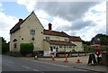
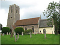
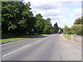
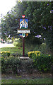
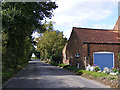
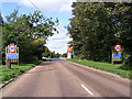
Photos of NR10 3GR


Area Information
Living in NR10 3GR means residing within a compact residential cluster defined by its specific postcode. This area covers 4821 square metres and houses a population of 1900 people, creating a neighbourhood with a manageable scale. You will find a population density of 127 people per square kilometre, which suggests a tranquil environment without the saturation of larger urban centres. The setting offers the quiet of a small residential grouping while maintaining access to the wider infrastructure of the Norfolk region. Daily life here revolves around a community where neighbours likely know one another, given the limited physical footprint. The area functions as a distinct pocket of housing rather than a sprawling town centre. You are part of a specific postcode environment that prioritises residential privacy and peaceful living. The small size ensures that you are never far from your local street, yet you remain well-connected to essential services outside the immediate boundaries. This blend of intimacy and accessibility makes NR10 3GR a practical choice for those seeking a grounded postcode location.
- Area Type
- Postcode
- Area Size
- 4821 m²
- Population
- 1900
- Population Density
- 127 people/km²
The property market in NR10 3GR is characterised by a strong emphasis on home ownership. With 74% of households owning their properties, this postcode is an owner-occupied area rather than a rental-heavy zone. You will find that the majority of homes in NR10 3GR are houses, consistent with the established nature of the residents. This high ownership rate suggests that property owners have made a long-term investment in their buildings, even within this small 4821 square metre area. The market focuses on traditional housing stock rather than rental flats or student accommodation. If you are buying homes in NR10 3GR, you are entering a market defined by stability and seasoned owners. The predominance of houses means you are looking at larger plots of land and private gardens, which are not typically found in dense rental districts. This data indicates a market where sellers have secured title deeds and residents are unlikely to move frequently. The absence of a significant rental sector reduces competition from short-term letting, though you should evaluate local demand trends for the wider Norwich area when pricing your home. Buyers here invest in permanence, and the data confirms this trend through the ownership statistic.
House Prices in NR10 3GR
Showing 3 properties
| Address | Type | Beds | Baths | Last Sale Price | Last Sale Date | |
|---|---|---|---|---|---|---|
| 3 Barn View, Horsford, NR10 3GR | Bungalow | - | - | £400,000 | Oct 2021 | |
| 2 Barn View, Horsford, NR10 3GR | Bungalow | - | - | £375,000 | Aug 2021 | |
| 1 Barn View, Horsford, NR10 3GR | Bungalow | - | - | £375,000 | Jun 2021 |
Energy Efficiency in NR10 3GR
Your lifestyle in NR10 3GR is supported by several accessible amenities within practical reach. For retail needs, you have five notable options, including the East of England Co-operative Co, as well as Tesco Thorpe Mariott and Tesco Drayton. These supermarkets provide essential shopping without the need to travel far. Beyond retail, the area is conveniently located for travel, with one airport nearby: Norwich International Airport. This proximity allows you to fly without requiring a long commute. For rail travel, Norwich Railway Station is also a key feature, offering access to the national network. These three categories of amenities form the backbone of daily convenience for residents. You can manage your weekly shop, schedule flights, or catch a train with ease. The presence of these specific venues ensures that the small size of the postcode does not isolate you from major facilities. Life here balances the quiet of a residential cluster with the utility of nearby commercial and transport hubs.
Amenities
Schools
Families considering NR10 3GR will find Horsford CofE Infant School as the nearest educational facility. This primary school serves the early years of children living in the immediate surroundings of the postcode. The available data lists only this single institution in the nearby schools category, indicating a limited schooling catchment within walking distance. Since the data does not provide an Ofsted rating for Horsford CofE Infant School, you cannot verify its performance grade from the provided information. However, the presence of an infant school suggests that young children in the neighbourhood are supported by education in the vicinity of NR10 3GR. Parents will need to check the current status of secondary education options separately, as no secondary schools are listed for this specific area. The reliance on one named primary school highlights that older children may commute further for their education. When evaluating NM10 3GR for school purposes, note that while you have access to primary education locally, the school provision is narrower than in larger towns. You should investigate transport links to secondary schools outside this immediate cluster.
| Rank | School | Type | Entry gender | Ages |
|---|
Explore more schools in this area
Go to Schools tabDemographics
The community in NR10 3GR reflects a mature demographic profile. The median age stands at 47 years, placing the neighbourhood firmly within the adult demographic range of 30 to 64 years. Consequently, you are looking at an area populated primarily by working-age adults rather than young families or retirees. This age structure influences the demand for housing and local amenities. Over 74% of residents own their homes, indicating a stable, settled population with deep roots in the community. The remaining households are likely comprised of long-term renters or first-time buyers securing mortgages to join the owner-occupied majority. Houses dominate the accommodation types, meaning you will not find the high-rise blocks or flats common in city centres; instead, you will see detached or semi-detached family homes. The predominant ethnic group is White, which aligns with wider regional trends in East Anglia. There are no indications of a significantly diverse mix within this specific cluster. The data paints a picture of a traditional, homogeneous community where residents share similar economic stability and life stages. This homogeneity contributes to a consistent character across the neighbourhood.
Household Size
Accommodation Type
Tenure
Ethnic Group
Religion
Household Composition
Age
Household Deprivation
NS-SEC
Explore more demographic insights in this area
Go to Demographics tabPlanning
Planning Constraints
- Flood RiskPremium
- Ramsar Wetland SitesPremium
- Area of Outstanding Natural BeautyPremium
- Protected Nature ReservePremium
- Protected WoodlandPremium