Area Overview for NR1 2QR
Photos of NR1 2QR
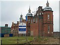
100 photos from this area
Area Information
Key information about the NR1 2QR including its size, population, and administrative classification.
- Area Type
- Postcode
- Area Size
- 1.2 hectares
- Population
- 1323
- Population Density
- 3217 people/km²
House Prices in NR1 2QR
32
Properties
£223,233
Average Sold Price
£52,000
Lowest Price
£503,000
Highest Price
Showing 32 properties
| Address | Type | Beds | Baths | Last Sale Price | Last Sale Date | |
|---|---|---|---|---|---|---|
| 100 Trafford Road, Norwich, NR1 2QR | house | - | - | £450,000 | Sep 2024 | |
| 104 Trafford Road, Norwich, NR1 2QR | Flat | - | - | £200,000 | Feb 2023 | |
| 57 Trafford Road, Norwich, NR1 2QR | house | - | - | £503,000 | Jan 2021 | |
| 96 Trafford Road, Norwich, NR1 2QR | house | - | - | £475,000 | Nov 2020 | |
| 55 Trafford Road, Norwich, NR1 2QR | Semi-detached | 3 | 2 | £348,500 | Feb 2019 | |
| 118 Trafford Road, Norwich, NR1 2QR | house | 3 | - | £350,000 | Oct 2014 | |
| 106A Trafford Road, Norwich, NR1 2QR | Flat | - | - | £125,000 | Dec 2013 | |
| 128A Trafford Road, Norwich, NR1 2QR | Flat | 1 | 1 | £81,500 | Dec 2010 | |
| 67 Trafford Road, Norwich, NR1 2QR | house | - | - | £200,000 | Nov 2010 | |
| 102 Trafford Road, Norwich, NR1 2QR | house | - | - | £235,000 | Sep 2010 |
Page 1 of 4
Energy Efficiency in NR1 2QR
Amenities
Schools
| Rank | School | Type | Entry gender | Ages |
|---|
Explore more schools in this area
Go to Schools tabDemographics
Household Size
One person
most common
Accommodation Type
Houses
most common
Tenure
79
majority
Ethnic Group
White
most common
Religion
N/A
most common
Household Composition
N/A
most common
Age
47
median
Adults (30-64 years)
most common
Household Deprivation
N/A
with no deprivation
NS-SEC
51
in Lower managerial occupations
Explore more demographic insights in this area
Go to Demographics tabPlanning
Planning Constraints
- Flood RiskPremium
- Ramsar Wetland SitesPremium
- Area of Outstanding Natural BeautyPremium
- Protected Nature ReservePremium
- Protected WoodlandPremium