Area Overview for NR1 2NQ
Photos of NR1 2NQ
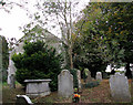
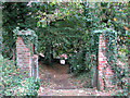
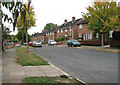
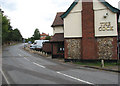
100 photos from this area
Area Information
Key information about the NR1 2NQ including its size, population, and administrative classification.
- Area Type
- Postcode
- Area Size
- 1.1 hectares
- Population
- 1591
- Population Density
- 2443 people/km²
House Prices in NR1 2NQ
28
Properties
£119,268
Average Sold Price
£48,500
Lowest Price
£167,500
Highest Price
Showing 28 properties
| Address | Type | Beds | Baths | Last Sale Price | Last Sale Date | |
|---|---|---|---|---|---|---|
| 101 Harwood Road, Norwich, NR1 2NQ | Flat | - | - | £136,000 | Nov 2019 | |
| 115 Harwood Road, Norwich, NR1 2NQ | Terraced | 3 | 2 | £167,500 | Nov 2017 | |
| 117 Harwood Road, Norwich, NR1 2NQ | Terraced | 2 | 2 | £149,995 | Aug 2015 | |
| 113 Harwood Road, Norwich, NR1 2NQ | Semi-detached | 3 | - | £149,950 | Apr 2014 | |
| 99 Harwood Road, Norwich, NR1 2NQ | Flat | 2 | - | £107,000 | Sep 2013 | |
| 85 Harwood Road, Norwich, NR1 2NQ | Semi-detached | 3 | - | £115,000 | May 2013 | |
| 111 Harwood Road, Norwich, NR1 2NQ | house | 3 | - | £115,000 | Mar 2012 | |
| 131 Harwood Road, Norwich, NR1 2NQ | house | - | - | £137,000 | Jan 2011 | |
| 123 Harwood Road, Norwich, NR1 2NQ | house | - | - | £114,000 | Oct 2009 | |
| 127 Harwood Road, Norwich, NR1 2NQ | house | - | - | £72,000 | Feb 2002 |
Page 1 of 3
Energy Efficiency in NR1 2NQ
Amenities
Schools
| Rank | School | Type | Entry gender | Ages |
|---|
Explore more schools in this area
Go to Schools tabDemographics
Household Size
Family (3-5 people)
most common
Accommodation Type
Houses
most common
Tenure
48
majority
Ethnic Group
White
most common
Religion
N/A
most common
Household Composition
N/A
most common
Age
47
median
Adults (30-64 years)
most common
Household Deprivation
N/A
with no deprivation
NS-SEC
20
in Lower managerial occupations
Explore more demographic insights in this area
Go to Demographics tabPlanning
Planning Constraints
- Flood RiskPremium
- Ramsar Wetland SitesPremium
- Area of Outstanding Natural BeautyPremium
- Protected Nature ReservePremium
- Protected WoodlandPremium