Area Overview for NR1 2AP
Photos of NR1 2AP


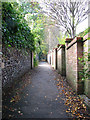


100 photos from this area
Area Information
Key information about the NR1 2AP including its size, population, and administrative classification.
- Area Type
- Postcode
- Area Size
- 1.1 hectares
- Population
- 1497
- Population Density
- 2422 people/km²
House Prices in NR1 2AP
14
Properties
£517,813
Average Sold Price
£250,000
Lowest Price
£785,000
Highest Price
Showing 14 properties
| Address | Type | Beds | Baths | Last Sale Price | Last Sale Date | |
|---|---|---|---|---|---|---|
| 58C Bracondale, Norwich, NR1 2AP | Bungalow | 2 | 2 | £350,000 | Apr 2024 | |
| 46 Bracondale, Norwich, NR1 2AP | Terraced | - | - | £785,000 | Aug 2023 | |
| 44 Bracondale, Norwich, NR1 2AP | Semi-detached | 3 | 1 | £515,000 | Jun 2021 | |
| 50 Bracondale, Norwich, NR1 2AP | Terraced | - | - | £680,000 | Mar 2020 | |
| 58B Bracondale, Norwich, NR1 2AP | Detached | 4 | 2 | £365,000 | Feb 2019 | |
| 48 Bracondale, Norwich, NR1 2AP | Terraced | 4 | 2 | £720,000 | Mar 2016 | |
| 52 Bracondale, Norwich, NR1 2AP | Terraced | - | - | £477,500 | Nov 2006 | |
| 40 Bracondale, Norwich, NR1 2AP | Semi-detached | 4 | - | £250,000 | Jan 2002 | |
| Manor Cottage, 54A Bracondale, Norwich, NR1 2AP | Retail | 3 | 1 | - | - | |
| The Manor House, 54 Bracondale, Norwich, NR1 2AP | Detached | 4 | 2 | - | - |
Page 1 of 2
Energy Efficiency in NR1 2AP
Amenities
Schools
| Rank | School | Type | Entry gender | Ages |
|---|
Explore more schools in this area
Go to Schools tabDemographics
Household Size
One person
most common
Accommodation Type
Houses
most common
Tenure
47
majority
Ethnic Group
White
most common
Religion
N/A
most common
Household Composition
N/A
most common
Age
47
median
Adults (30-64 years)
most common
Household Deprivation
N/A
with no deprivation
NS-SEC
28
in Lower managerial occupations
Explore more demographic insights in this area
Go to Demographics tabPlanning
Planning Constraints
- Flood RiskPremium
- Ramsar Wetland SitesPremium
- Area of Outstanding Natural BeautyPremium
- Protected Nature ReservePremium
- Protected WoodlandPremium