Area Overview for Northwell Ward
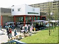
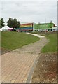
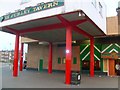
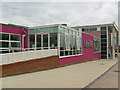
Photos of Northwell Ward


Area Information
Northwell Ward stands as a parliamentary district within the Luton unitary authority in Bedfordshire, covering a total land area of 2.2 square kilometres. This compact space accommodates 1,271 residents, creating a population density of 582 people per square kilometre. The ward encompasses the suburb of Marsh Farm and rests at coordinates near 51.919°N 0.452°W. You are looking at a defined locality where the built environment and natural spaces intersect closely. Unlike sprawling districts, this area offers a concentrated living experience where neighbours are likely to know one another. The location places you in the north of Luton, putting you within the East of England region. Every footprint of the 2.2 km² is accounted for in the local planning records. You inhabit an area where the ward boundary maps clearly define the streets of Marsh Farm and surrounding neighbourhoods. Daily life here involves a direct connection to the specific geography of Luton without the dilution found in larger administrative zones. The scale ensures that local services, transport routes, and community landmarks remain accessible to all 1,271 individuals calling this part of England home.
- Area Type
- District Borough Unitary Ward
- Area Size
- 2.2 km²
- Population
- 1271
- Population Density
- 582 people/km²
Demographics
The community profile of Northwell Ward reveals a population with a median age of 70 years. This figure indicates a significant shift towards older residents compared to the national average. The most common age range data shows the weight of this demographic skew across the ward. With only 1,271 people living in an area of 2.2 square kilometres, the social fabric revolves heavily around mature adults and retirees. Home ownership stands at 58 per cent, meaning more than half of the households own their property outright or with a mortgage. This level of ownership stability typically correlates with long-term residents who have settled in the area. Household composition and accommodation type statistics round out the profile of this section of Luton. The demographic data suggests a quiet environment where retirement communities and families might still be present but in smaller numbers. You are considering a ward where the daily rhythm is dictated by a much older population group. This profile influences local demand for services such as healthcare and leisure facilities suitable for seniors rather than child-centric amenities. The housing stock must therefore cater to the mobility and accessibility needs of a majority of its residents.
Household Size
Accommodation Type
Tenure
Ethnic Group
Religion
Household Composition
Age
Household Deprivation
NS-SEC
Explore more demographic insights in this area
Go to Demographics tabPlanning
Planning Constraints
- Flood RiskPremium
- Ramsar Wetland SitesPremium
- Area of Outstanding Natural BeautyPremium
- Protected Nature ReservePremium
- Protected WoodlandPremium
- Crime RiskPremium