Area Overview for Northrepps
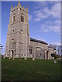
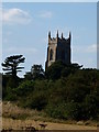
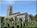
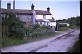
Photos of Northrepps
Area Information
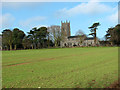
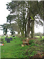
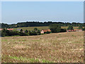
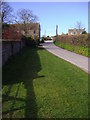
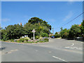
Northrepps is a small civil parish in Norfolk, covering an area of 10.6 km². It presents a quiet, rural setting ideal for those seeking a slower pace. The community is defined by its stability and established character rather than rapid development. Living in Northrepps means embracing a life close to nature within a defined geographical boundary. The parish offers a distinct sense of place without the noise of larger towns. You will find the landscape is undisturbed by major infrastructure projects or protected wetland sites. This makes daily commutes to nearby services straightforward where needed. The area is suitable for residents who value privacy alongside access to the broader Norfolk countryside. Homes here provide a foundation for a lifestyle centred on local routines. Whether you are retiring or looking for a change of scenery, the parish delivers a consistent environment. You do not face the constraints of designated nature reserves or controversial planning zones. Instead, you enjoy a space where the environment remains low-risk for flooding. The community feels settled, with long-term ties linking residents to the land. Northrepps stands as a reliable choice for those prioritising tranquility and natural surroundings.
- Area Type
- Parish
- Area Size
- 10.6 km²
- Population
- Not available
- Population Density
- Not available
Demographics
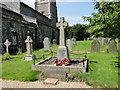
The community in Northrepps reflects a settled, mature population. The median age is 70, indicating a territory where older generations reside. This demographic profile suggests a prevalence of retirees or residents in later life stages. Most households fall into the older age bracket, shaping the social fabric of the parish. Home ownership stands at a high 74%, which signals deep roots within the community. Few residents rent, meaning most people have invested heavily in their local properties. This high retention rate often correlates with families who have spent decades in the parish. Accommodation types reflect this longterm settlement, though specific breakdowns are not available in the current dataset. You will likely encounter a neighbourhood where neighbours know each other by name. The low crime risk reinforces the peaceful nature of this demographic mix, with a safety score of 70 out of 100. Ethnical diversity and religious composition are noted as general totals in available records, suggesting a traditional community make-up. For homebuyers, this indicates an area that resists transient populations. The population density and age structure create a stable environment where you can expect continuity in local interactions. Northrepps remains a place where residents stay for the long haul, not just for a few years.
Household Size
Accommodation Type
Tenure
Ethnic Group
Religion
Household Composition
Age
Household Deprivation
NS-SEC
Explore more demographic insights in this area
Go to Demographics tabPlanning
Planning Constraints
- Flood RiskPremium
- Ramsar Wetland SitesPremium
- Area of Outstanding Natural BeautyPremium
- Protected Nature ReservePremium
- Protected WoodlandPremium
- Crime RiskPremium