Area Overview for North Walsham West Ward
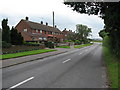
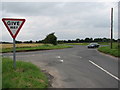
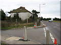
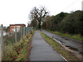
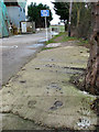
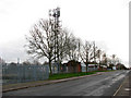
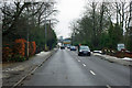
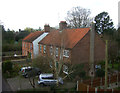
Photos of North Walsham West Ward

Area Information
North Walsham West Ward stands as a distinct district council ward within the wider North Norfolk area of East Anglia. This specific locality spans roughly 10.3 km² and forms part of the electoral representation for North Norfolk District Council. Current boundary mapping shows that North Walsham West is now combined with Mundesley as a single electoral ward to serve the local population. The coordinates of this ward place it firmly within the north Norfolk coastal region, offering a setting that blends rural accessibility with proximity to the coast. Living in North Walsham West Ward means residing in an area that has undergone administrative consolidation to better reflect modern neighbour communities. The ward exists alongside other 32 electoral divisions that make up the district, ensuring dedicated local representation. You generally find yourself in a compact area where the administrative structure merges traditional ward boundaries to streamline council services. This configuration affects how local issues are raised and addressed, placing North Walsham West and Mundesley under one electoral umbrella. The physical layout covers a specific footprint that connects the broader North Norfolk landscape while maintaining its own identity as a defined ward. Prospective residents should note that the area operates within this specific administrative framework, which influences local governance and service delivery. The ward's position allows for a practical daily life where the distinction between the ward and the merged community remains relevant for administrative purposes.
- Area Type
- District Borough Unitary Ward
- Area Size
- 10.3 km²
- Population
- Not available
- Population Density
- Not available
Demographics
The community profile of North Walsham West Ward reveals an older demographic compared to national averages. Data indicates a median age of 70 years for the population living in this ward. This statistical reality defines the social fabric, suggesting a neighbourhood composed largely of older residents or retirees rather than young families new to the workforce. Private home ownership stands at 67% of households within the ward, indicating a significant portion of the population owns their property outright or via mortgage. This high level of ownership often correlates with long-term residents who have stayed in the area for decades. The age data suggests that the ward is not populated by a young cohort seeking to enter the housing market. Instead, the demographic landscape points towards a stable, established population where house prices and rental demand may reflect the needs of an older buyer base. When considering homes in North Walsham West Ward, you are entering a market influenced by an ageing population structure. The household composition data, while categorised as total figures, supports the view that the area services a specific age bracket rather than a mixed generational mix. Understanding that the median age is 70 helps you visualise the daily rhythm of the village and the types of amenities that likely see the most frequent use.
Household Size
Accommodation Type
Tenure
Ethnic Group
Religion
Household Composition
Age
Household Deprivation
NS-SEC
Explore more demographic insights in this area
Go to Demographics tabPlanning
Planning Constraints
- Flood RiskPremium
- Ramsar Wetland SitesPremium
- Area of Outstanding Natural BeautyPremium
- Protected Nature ReservePremium
- Protected WoodlandPremium
- Crime RiskPremium