Area Overview for Sprowston
Photos of Sprowston


Area Information
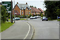
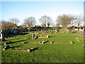
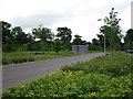
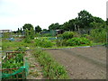
Sprowston stands as a distinct county electoral division within Norfolk, situated approximately nine and a half square kilometres from the regional hub of Norwich. This suburban location accommodates a population of 4,311 residents, creating a relatively dense environment averaging 455 people per square kilometre. The area carries historical weight, having been formally described as a village, parish, and sub-district as early as 1870. Its administrative boundaries have shifted over time, moving from the Rural District of St Faith and Aylsham to the parliamentary constituency of Norwich North following boundary changes in 1983. Today, living in Sprowston offers a blend of rural heritage and suburban convenience. The community includes the parish church of St Mary and St Margaret, whose cemetery contains gravestones available for those interested in genealogical research. You are accessing a neighbourhood that evolved from a traditional parish structure into a modern residential zone adjacent to Norwich. The area size supports a high concentration of homes, ensuring that daily needs are within comfortable reach for most residents.
- Area Type
- Parish
- Area Size
- 9.5 km²
- Population
- 4311
- Population Density
- 455 people/km²
Demographics
The community profile of Sprowston reveals a mature population, with a median age of 70 years. This demographic skew suggests an area dominated by older residents who likely value quiet and stability. While specific data on the precise age ranges beyond the median is not detailed, the high median age points toward a settlement where families with young children may be in the minority. House ownership remains the dominant form of tenure, with 78% of households owning their homes outright or via mortgage. This high ownership rate indicates that Sprowston is largely an established area where residents have long-term roots rather than a volatile rental sector. The accommodation types and household composition reflect this stable environment. Although the data does not specify the predominant ethnic group or religious breakdown, the demographic consistency implies a settled community. You can expect an environment where the majority of neighbours own their properties, fostering a sense of permanence. The low population density relative to the median age suggests a slower pace of life, suitable for those seeking retirement living or a quiet residential setting away from the faster-paced centre of the city.
Household Size
Accommodation Type
Tenure
Ethnic Group
Religion
Household Composition
Age
Household Deprivation
NS-SEC
Explore more demographic insights in this area
Go to Demographics tabPlanning
Planning Constraints
- Flood RiskPremium
- Ramsar Wetland SitesPremium
- Area of Outstanding Natural BeautyPremium
- Protected Nature ReservePremium
- Protected WoodlandPremium