Area Overview for Damgate
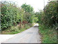
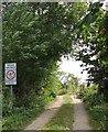
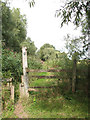
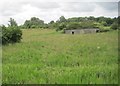
Photos of Damgate

Area Information
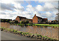
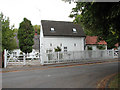
Damgate is a compact built-up area in England, covering 25.5 hectares. Its modest size means it is neither sprawling nor densely packed, offering a manageable footprint for residents. The area’s population skews older, with a median age of 70, suggesting a community shaped by long-term residents and perhaps retirees. Living in Damgate involves proximity to practical amenities, with five nearby railway stations—Acle, Lingwood, and Cantley among them—providing regular connections to surrounding towns. Retail options include the East of England Co-operative Co and M&S Acle BP, while the Reedham Ferry North offers access to water-based travel. The area’s character is defined by its accessibility to transport networks and the quiet rhythm of daily life, with a focus on convenience rather than urban sprawl. For buyers, Damgate presents a niche opportunity to own property in a location that balances simplicity with connectivity, though its appeal may hinge on specific lifestyle needs.
- Area Type
- Built Up Area 250
- Area Size
- 25.5 hectares
- Population
- Not available
- Population Density
- Not available
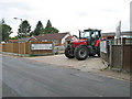
Daily life in Damgate is shaped by its proximity to practical amenities. The East of England Co-operative Co and M&S Acle BP provide essential retail and fuel services, while Spar offers convenience shopping. The Reedham Ferry North connects residents to water-based travel, though its frequency may vary. Five railway stations—Acle, Lingwood, and Cantley among them—ensure regular access to regional transport, reducing the need for private cars. The area’s small size means these amenities are within walking or short driving distance, fostering a sense of self-sufficiency. While there is no mention of parks or leisure facilities in the data, the availability of retail and transport options suggests a focus on functional living. For buyers, the lifestyle in Damgate is defined by simplicity, with an emphasis on accessibility over luxury.
Amenities
Schools
| Rank | School | Type | Entry gender | Ages |
|---|
Explore more schools in this area
Go to Schools tabDemographics
Damgate’s population is predominantly older, with a median age of 70. This suggests a community where retirement is the norm, and daily life may revolve around established routines. Home ownership is high, with 68% of residents living in properties they own, indicating a stable housing market. The data does not specify household composition or accommodation types, but the overall figures suggest a mature demographic profile. The area’s diversity is not quantified, but the “total” category for ethnic groups and religions implies a lack of detailed breakdowns. This could mean the population is relatively homogenous or that the data aggregates multiple groups. For buyers, the high home ownership rate and older demographic may signal a low turnover of properties, which could affect availability and pricing.