Area Overview for Watton
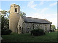
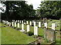
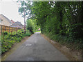
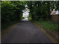
Photos of Watton
Area Information
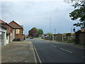
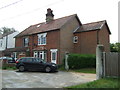
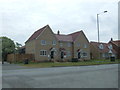
Watton is a civil parish located in England, covering an area of 7.2 km². The community is defined by a settled population of 1,390 residents, creating a neighbourhood where daily life moves at a considered pace. The population density stands at 193 people per square kilometre. This figure indicates a residential area that retains a village feel rather than the intensity of a larger town. Those considering living in Watton will find a setting that balances isolation with local accessibility. The geography supports a quiet lifestyle while maintaining connections to the surrounding regions. You can find homes in Watton that offer established gardens and proximity to local amenities. The parish structure provides a formal administrative boundary that helps define the community identity. Deciding to move here means embracing a specific character defined by its size and population. The area is not a sprawling urban zone but a cohesive parish with clear boundaries. Your daily routine will likely involve walking to local spots as the scale remains compact. Living in Watton appeals to those seeking a defined, manageable environment away from major city hubs.
- Area Type
- Parish
- Area Size
- 7.2 km²
- Population
- 1390
- Population Density
- 193 people/km²
Demographics
The community profile in Watton reflects an established older population. The median age is 70 years old. This demographic fact suggests the area is dominated by retirees and long-term residents rather than young families seeking upward mobility. You will find that the most common age group falls within the total age range, meaning the population is spread across various stages of retirement. Home ownership accounts for 70% of households. This high possession rate indicates a stable community where families have often lived in their properties for decades. The remaining 30% are either renting or living in shared ownership arrangements. The accommodation type data reflects a mix of dwellings built to meet the needs of this age profile over many years. Deprivation levels are not explicitly detailed in the current statistics for this parish. The ethnic composition and religious affiliations follow the general pattern of the broader region without specific outliers recorded here. Living in Watton means accepting a demographic reality where tradition and stability define the social fabric. The household composition is traditional, with few transient residents moving through the system each year.
Household Size
Accommodation Type
Tenure
Ethnic Group
Religion
Household Composition
Age
Household Deprivation
NS-SEC
Explore more demographic insights in this area
Go to Demographics tabPlanning
Planning Constraints
- Flood RiskPremium
- Ramsar Wetland SitesPremium
- Area of Outstanding Natural BeautyPremium
- Protected Nature ReservePremium
- Protected WoodlandPremium