Area Overview for Newbourne
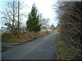
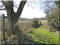
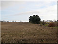
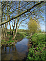
Photos of Newbourne


Area Information
Living in Newbourne means residing within a compact built-up area covering 57.9 hectares in Suffolk, England. This location is defined by its small scale and intimate character as a distinct neighbourhood within the wider region. You will find a community where residents enjoy close proximity to established towns without the密度 of a major city centre. The area's size suggests a village-like atmosphere where neighbours are likely familiar with one another. Daily life here is shaped by the surrounding landscape and the practical accessibility of key transport hubs. Prospective residents are buying into an established settlement rather than a sprawling suburban development. The environment supports a quiet routine for those who prioritise space over urban convenience. You can expect to see traditional housing stock rather than modern high-rise blocks. The area serves as a residential pocket with direct links to broader networks. Your experiences here will be shaped by the local rhythm and the specific amenities located just outside the immediate boundary. Newbourne offers a grounded lifestyle for families and individuals seeking stability in a defined locality.
- Area Type
- Built Up Area 250
- Area Size
- 57.9 hectares
- Population
- Not available
- Population Density
- Not available
Your daily routine in Newbourne will be influenced by the specific amenities reachable within a short drive. Shopping opportunities include Aldi Gloster and Morrisons Daily Martlesham for your weekly groceries. You might also find branded names like M&S Martlesham Heath SF nearby for household essentials. These retail outlets provide the convenience of supermarket shopping without the need to travel into a larger urban centre. Transport links offer multiple ways to leave the local area. Woodbridge Railway Station provides rail connections for those wishing to travel further. In addition to trains, you have access to five ferry locations including Felixstowe for Bawdsey Ferry Landing and Shotley Point Marina Ferry Landing. These options provide direct routes to coastal destinations and mainland ferries. You can combine a walk along the coast with a ferry crossing for a holiday or commute. The presence of these six modes of transport means you are not reliant on a single route for your journey. Living in Newbourne gives you practical access to both road and water-based travel networks.
Amenities
Schools
| Rank | School | Type | Entry gender | Ages |
|---|
Explore more schools in this area
Go to Schools tabDemographics
The community in Newbourne is notably older than the national average, with a median age of 70 years. This demographic profile indicates a neighbourhood dominated by retirees and long-term residents rather than young families or single professionals. You are looking at a population where the majority of households consist of older individuals living independently or with spouses. The area does not cater strongly to young adults or university students based on the age distribution data. Homeownership is the prevailing tenure type, with 78% of residents owning their homes outright or with a mortgage. This high ownership figure reinforces the impression of a stable, settled community where people have deep roots in the locality. The remaining 22% of households consist mainly of tenants or owner-occupiers with smaller properties. You will not find a transient population or a high concentration of short-term rentals. The demographic structure suggests a peaceful environment where residents plan to stay for the long term. When considering what is like living in Newbourne, expect to interact with an establishment crowd familiar with local traditions and history.
Household Size
Accommodation Type
Tenure
Ethnic Group
Religion
Household Composition
Age
Household Deprivation
NS-SEC
Explore more demographic insights in this area
Go to Demographics tabPlanning
Planning Constraints
- Crime RiskPremium