Area Overview for Nedging Tye
Photos of Nedging Tye


Area Information
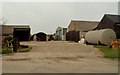
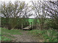
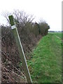
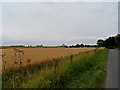
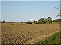
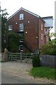
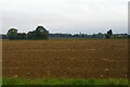
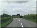
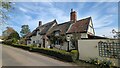
Nedging Tye stands as a built-up area covering roughly 31.5 hectares within England. It functions as a distinct settlement that offers a clear sense of place for those seeking a specific lifestyle. The location feels established and settled, separate from the more intense pressure of a major city centre. Residents here experience a daily rhythm that is defined by its proximity to rail links and local retail hubs rather than urban density. You will find a neighbourhood where the scale remains manageable, allowing for a quiet existence without being completely isolated. The area connects naturally to wider road networks and provides access to significant infrastructure like RAF Wattisham, yet it retains a residential character. Living in Nedging Tye means you are settled in a community where the focus remains on established patterns rather than rapid growth. The size of the land, at just over 30 hectares, suggests a compact living environment where amenities are reachable on foot or a short drive. You are buying into an area that has developed steadily over time.
- Area Type
- Built Up Area 250
- Area Size
- 31.5 hectares
- Population
- Not available
- Population Density
- Not available
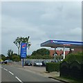
Early mornings or quick errands in Nedging Tye bring you to a cluster of practical amenities within easy reach. Five retail outlets serve the local population, including Morrisons Hadleigh, Spar, and the East of England Co-operative Co. These shops form the commercial heart where residents grab groceries and essentials daily. The diversity of these stores ensures you can find everything from fresh produce to household necessities. One airport facility, RAF Wattisham, sits nearby, adding a touch of industrial landscape to the horizon. Four railway stations frame the border of the area, providing essential links to the wider network. Living in Nedging Tye means your daily life revolves around these accessible points of interest rather than distant shopping centres. You do not need to travel far to stock your pantry or send a child to a train station. The availability of these specific venues, such as the Spar and the Co-op, makes self-sufficiency simple for householders in this built-up zone.
Amenities
Schools
| Rank | School | Type | Entry gender | Ages |
|---|
Explore more schools in this area
Go to Schools tabDemographics
The community in Nedging Tye displays a demographic profile with a median age of 70 years. This figure indicates that the population skews significantly towards older adults. You are looking at a neighbourhood where many residents have settled in for life. The home ownership standing is firmly at 76 percent, creating a landscape owned by those who have rooted themselves in the area. With such a high rate of ownership, the rental market remains a smaller component of the local economy. Household composition and accommodation type data point to a settled population pattern rather than transient living. The population structure suggests a quiet retirement setting rather than a hub for young families. The racial and religious diversity metrics are recorded for the total population, reflecting the broader national context rather than a unique local subculture. This demographic reality shapes the local services and social interactions you will encounter. You must be prepared for a neighbourhood where established residents form the dominant group.
Household Size
Accommodation Type
Tenure
Ethnic Group
Religion
Household Composition
Age
Household Deprivation
NS-SEC
Explore more demographic insights in this area
Go to Demographics tabPlanning
Planning Constraints
- Crime RiskPremium