Area Overview for Necton
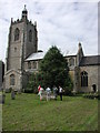
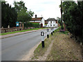
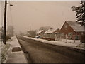
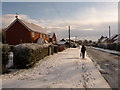
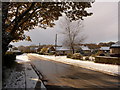
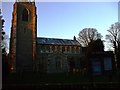
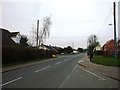
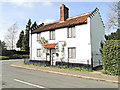
Photos of Necton

Area Information
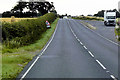
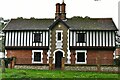
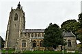
Necton is a built-up area covering 83.2 hectares in England, offering a defined residential landscape for those seeking a settled environment. The location combines the stability of a town setting with ample space, making it a practical choice for residents who value clear boundaries between their home and the wider community. Living in Necton means being part of a locality where the physical footprint supports a traditional, low-density atmosphere. You will find yourself in an area designed for habitation rather than high-density urban living, which often results in quieter streets and a slower pace of daily life. The area's size allows for distinct neighbourhood character without the overwhelming scale of a large city centre. This structured layout appeals to individuals and families who prefer a predictable environment where the layout supports easy navigation. The distinct nature of Necton provides a solid foundation for those prioritising a stable, nicht-chaotic lifestyle. You can expect a setting where the built environment serves clear residential purposes, free from the complexity of mixed-use commercial zones. This straightforward character defines your day-to-day experience, from walking to local shops to driving to nearby services. The area stands as a reliable option for buyers who want their home in a place that functions efficiently and clearly.
- Area Type
- Built Up Area 250
- Area Size
- 83.2 hectares
- Population
- Not available
- Population Density
- Not available
Residents of Necton have access to five retail outlets within practical reach, providing essential shopping needs. You can visit Asda Necton for large grocery requirements or select from Iceland Swaffham and Morrisons Daily Swaffham 49/51 for specific items. These venues form the core of the local shopping experience, eliminating the need to travel far for daily necessities. The concentration of supermarkets means you can manage your household shopping without leaving the immediate vicinity of the area. This retail setup offers convenience for those who prefer short trips for their weekly groceries. Dining options are implicit in the presence of these large stores, though specific restaurants are not detailed in the available data. The 83.2 hectare area supports a lifestyle centred around convenient access to established supermarket chains. You will find that major brands dominate the local retail scene, providing familiarity and consistency. This arrangement suits residents who prioritise practical shopping over niche boutique experiences. The proximity of Asda and Morrisons ensures that food security and household supplies are easily managed. Your daily routine can include stopping at these stores for essentials, making life in Necton efficient and straightforward.
Amenities
Schools
Three schools serve the educational needs of children living in and near Necton, each with specific designations and ratings. Necton Voluntary Controlled Middle School operates as a primary institution, offering education to younger pupils within the community. You will also find Necton Church of England First School, another primary option that caters to infants and young learners. Necton VA Primary School holds a good Ofsted rating, providing quality education under voluntary aided status. This mix of primary schools means that Necton serves as a hub for early years and primary education, though secondary education likely relies on facilities further afield. For families with school-age children, the presence of a school with a good rating is a significant positive factor. The variety of primary options ensures that parents have choices local to the 83.2 hectare area. All three listed schools operate at the primary level, indicating that this neighbourhood functions primarily as a feeder area for young children. When assessing schools near Necton, you must look beyond this immediate zone for secondary education, as none are listed in the local data. The educational infrastructure supports the resident demographic, focusing on the early stages of schooling.
| Rank | School | Type | Entry gender | Ages |
|---|
Explore more schools in this area
Go to Schools tabDemographics
The community in Necton has a distinct age profile, with a median age of 70. This statistic confirms that the neighbourhood is predominantly occupied by older residents, which shapes the overall social dynamic. You are moving into an area where the most common demographic group consists of seniors, influencing the local culture and pace of life. With 78% of residents owning their homes, the community reflects long-term stability rather than transient living arrangements. High ownership rates suggest that many inhabitants have settled in the area for decades, building deep roots within the 83.2 hectare boundary. This ownership model typically leads to quieter streets and less turnover compared to areas dominated by rented accommodation. The household composition and accommodation types in your postcode district align with this older, owner-occupied demographic. You will find a community where neighbours often know one another over generations, fostering a strong sense of locality. The lack of significant youth or young family populations indicates a retirement-focused or retired community. When considering the diverse demographics within Necton, you will see a clear pattern of older adults living in their owned properties. This demographic reality helps define the social atmosphere, where interactions centre on shared experiences of aging and established routines.
Household Size
Accommodation Type
Tenure
Ethnic Group
Religion
Household Composition
Age
Household Deprivation
NS-SEC
Explore more demographic insights in this area
Go to Demographics tabPlanning
Planning Constraints
- Crime RiskPremium