Area Overview for Narborough
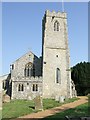
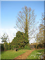
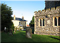
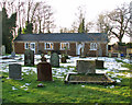
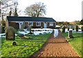
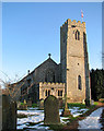
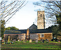
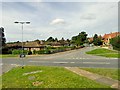
Photos of Narborough


Area Information
Living in Narborough offers a quiet, rural experience within a defined built-up area covering 59.6 hectares. The settlement is not a bustling city centre but a distinct village feel found in the Norfolk countryside. This environment suits those seeking space and calm over urban convenience. You will find streets lined with traditional homes surrounded by greenery rather than high-rises. The area functions as a local hub where daily life revolves around nearby amenities rather than expensive city shopping. The character of Narborough is shaped by its small footprint and wide-open surroundings. It is a place where neighbours often know each other and the pace of life remains slow. Residents appreciate the proximity to nature while maintaining access to essential services in Swaffham. This balance makes it attractive to people who want a home with character without being isolated. The layout supports a community lifestyle where people walk to local shops and meet in village greens. Buying a home in Narborough means entering a market defined by limited space and established layouts. The area does not offer the anonymity of a large town but provides a tight-knit atmosphere. You will enjoy a setting where the sun rises over fields rather than office blocks. This distinct setting defines every aspect of living in this small built-up community.
- Area Type
- Built Up Area 250
- Area Size
- 59.6 hectares
- Population
- Not available
- Population Density
- Not available
Daily life in Narborough centres on a small selection of nearby amenities within practical reach. Retail options include Budgens Castle and Waitrose Swaffham, alongside Tesco Swaffham, offering essential shopping for groceries and household items. These five retail locations are close enough for regular visits without needing a car. The presence of a Budgens suggests a corner shop experience for immediate needs. RAF Marham serves as the nearest airport, providing air travel links for residents who fly occasionally. While not a hub for frequent business flyers, it offers connectivity for vacations and special trips. The lack of major leisure centres nearby means visitors often travel to larger towns for entertainment. Parks and local green spaces likely exist within the 59.6 hectares, though specific named parks are not listed in the data. Your routine will involve driving or cycling to Swaffham for larger purchases. The cluster of four named retailers confirms a functioning local economy despite the village's small size. You will not find a cinema or large entertainment complex nearby. Dining remains limited to standard retail offerings rather than a culinary scene. This lifestyle prioritises convenience and necessity over urban luxuries. You manage your life by planning trips to the main nearby towns for non-essential shopping.
Amenities
Schools
Families considering Narborough have access to two primary schools within the locality. Narborough Church of England Voluntary Controlled Primary School serves students in the local community with a standard curriculum. Nearby, Narborough Church of England Primary Academy holds a "good" Ofsted rating, providing assurance of quality education. The presence of Church of England schools reflects the historical character of the village. Schools in this area cater primarily to primary-aged children, as high and secondary institutions are not listed in the immediate vicinity. The "good" rating of Narborough Church of England Primary Academy suggests it meets current educational standards effectively. Parents relying on these schools would find them accessible within the built-up area bounds. If you plan to raise children here, you must commute to secondary schools outside the immediate area. The local primary options ensure young children do not travel far for early education. However, the absence of secondary school data means families need to factor in travel time for older students. The focus on primary education aligns with the older demographic profile, as many households include elderly parents rather than young families. You will find no specialist academies or comprehensive schools listed in the immediate data for Narborough.
| Rank | A + A* % | School | Type | Entry gender | Ages |
|---|---|---|---|---|---|
| 1 | N/A | Narborough Church of England Voluntary Controlled Primary School | primary | N/A | N/A |
| 2 | N/A | Narborough Church of England Primary Academy | primary | N/A | N/A |
Explore more schools in this area
Go to Schools tabDemographics
The community in Narborough presents a clear demographic profile dominated by older residents. The median age stands at 70 years, indicating a population significantly older than the national average. This age distribution suggests the area attracts retirees seeking a peaceful location for their later years. Most households reflect this ageing population, which influences local demand and community activities. Home ownership levels in Narborough are high, with 67% of residents owning their properties outright or with a mortgage. This figure far exceeds the rental market share, creating a stable environment where families and individuals remain for the long term. The dominant presence of owner-occupiers shapes the neighbourhood character and reduces transient populations. Accommodation types align with this trend, featuring terraced and semi-detached houses typical of a historic village rather than modern high-density developments. This demographic makeup means you will encounter a mature community focused on comfort and stability. The low percentage of young families correlates with the age data and limits public transport demand relative to larger towns. Ethnic diversity data is not provided, but the homogeneity suggests a traditional English village feel. Religion and specific household composition details are absent from the available records, yet the high ownership rate remains a defining statistic. Your daily interactions will likely involve neighbours who have lived here for decades.
Household Size
Accommodation Type
Tenure
Ethnic Group
Religion
Household Composition
Age
Household Deprivation
NS-SEC
Explore more demographic insights in this area
Go to Demographics tabPlanning
Planning Constraints
- Crime RiskLocked