Area Overview for Moreton Hall Ward
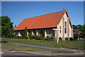
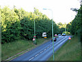
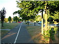
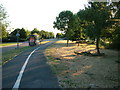
Photos of Moreton Hall Ward


Area Information
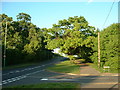
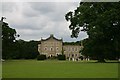
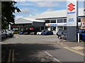
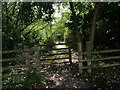
Moreton Hall Ward sits within the administrative boundaries of West Suffolk Council, situated in Bury St Edmunds, Suffolk. This district ward occupies a compact footprint of 3.4 km², covering postcodes primarily in the IP33 9** range. Located at approximately 52.2422°N, 0.7531°E, the area centres on the OS grid reference TL880640. Residents here experience daily life within a defined local governance structure that functions as part of the broader Bury St Edmunds region in the East of England. The ward represents a specific electoral division with clear boundaries documented by West Suffolk Council. Living in Moreton Hall Ward means engaging with a defined local community that operates under these established administrative coordinates. The area functions as a distinct neighbourhood unit within the larger Suffolk landscape.
- Area Type
- District Borough Unitary Ward
- Area Size
- 3.4 km²
- Population
- Not available
- Population Density
- Not available
Demographics
The population of Moreton Hall Ward displays a clear demographic skew, with a median age of 70 years. Among all age groups, the data indicates that the total age population is the most significant category available for this specific ward. This age profile suggests the ward houses a significant proportion of older residents or retirees. Home ownership stands at a strong 68% across the area, indicating that the majority of people live in their own homes rather than renting. Household composition and accommodation type data categorised inform the structure of local living arrangements, though specific breakdowns for these categories are not itemised in the provided records. The predominant ethnic group, religious affiliation, and detailed household composition statistics are recorded as total figures in the dataset. Living in Moreton Hall Ward means joining a community where property tenure is predominantly private and the age profile is substantially older than the national average.
Household Size
Accommodation Type
Tenure
Ethnic Group
Religion
Household Composition
Age
Household Deprivation
NS-SEC
Explore more demographic insights in this area
Go to Demographics tabPlanning
Planning Constraints
- Flood RiskPremium
- Ramsar Wetland SitesPremium
- Area of Outstanding Natural BeautyPremium
- Protected Nature ReservePremium
- Protected WoodlandPremium
- Crime RiskPremium