Area Overview for MK45 5NS
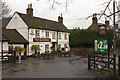
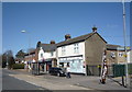
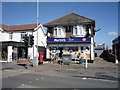
Photos of MK45 5NS


Area Information
MK45 5NS is a small residential cluster in England, home to 1,539 people spread across a densely populated area of 891 people per square kilometre. This compact postcode area reflects a mature community, with a median age of 47 and a majority of residents aged 30–64. The area’s character is defined by its proximity to essential services, including nearby rail stations and retail outlets, which cater to daily needs. While the population is relatively small, the area benefits from a mix of amenities that support both practical living and connectivity. The presence of a primary school with a good Ofsted rating underscores its appeal to families, though the broader educational landscape remains limited to this single institution. The low flood risk and absence of environmental constraints make it a stable choice for long-term residence. For those seeking a quiet, well-connected neighbourhood with a focus on practicality, MK45 5NS offers a straightforward, no-frills living experience.
- Area Type
- Postcode
- Area Size
- Not available
- Population
- 1539
- Population Density
- 891 people/km²
The property market in MK45 5NS is defined by a low home ownership rate of 35%, which suggests that a majority of the area’s housing stock is occupied by renters. This contrasts with the accommodation type, which is primarily houses, indicating that the area’s housing stock is not dominated by apartments or flats. The combination of owner-occupied and rental properties may appeal to buyers seeking a balance between stability and flexibility. However, the small size of the area and its limited housing diversity mean that options for buyers are constrained. The predominance of houses may be attractive to those prioritising space, but the low home ownership rate could indicate limited opportunities for long-term investment. For prospective buyers, the market reflects a niche environment where availability is likely to be competitive, and proximity to amenities such as rail stations and retail outlets is a key selling point.
House Prices in MK45 5NS
No properties found in this postcode.
Energy Efficiency in MK45 5NS
The lifestyle in MK45 5NS is shaped by its proximity to essential retail and transport hubs. Nearby amenities include Budgens Flitwick, Co-op Flitwick, and Tesco Bedford, offering a range of shopping and grocery options within practical reach. These stores cater to daily needs, reducing the necessity for long commutes to larger retail centres. The area’s rail network, with stations at Flitwick, Harlington, and Millbrook, provides convenient access to regional destinations, enhancing both commuter and leisure opportunities. While the data does not specify parks or leisure facilities, the absence of environmental constraints and the low crime risk suggest a safe environment for outdoor activities. The combination of retail access and rail connectivity supports a practical, efficient lifestyle, though the area’s small size means that more extensive leisure options may require travel beyond the immediate vicinity.
Amenities
Schools
The only school listed in proximity to MK45 5NS is Kingsmoor Lower School, a primary institution with a good Ofsted rating. This school serves the local community’s younger residents, offering a foundation for early education. However, the absence of secondary schools or further education facilities in the immediate vicinity may necessitate travel for older students. The presence of a single primary school with a positive rating is a notable asset for families, though it does not provide a comprehensive educational ecosystem. For those prioritising school quality, this institution’s performance is a positive factor, but the lack of additional schools may limit options for households with children at different stages of their education.
| Rank | School | Type | Entry gender | Ages |
|---|
Explore more schools in this area
Go to Schools tabDemographics
The community in MK45 5NS is predominantly composed of adults aged 30–64, with a median age of 47. This suggests a population skewed toward middle-aged individuals, likely including professionals and families. Home ownership is relatively low at 35%, indicating that a significant portion of the housing stock is rented out. The area is characterised by houses as the primary accommodation type, which is uncommon in regions with higher apartment or flat density. The predominant ethnic group is White, reflecting a homogenous demographic profile. While this data does not include specific figures on deprivation, the low crime risk and absence of environmental hazards suggest a stable quality of life. The age range and ownership statistics imply a community that may include both long-term residents and those in transitional housing phases, such as young professionals or retirees.
Household Size
Accommodation Type
Tenure
Ethnic Group
Religion
Household Composition
Age
Household Deprivation
NS-SEC
Explore more demographic insights in this area
Go to Demographics tabPlanning
Planning Constraints
- Flood RiskPremium
- Ramsar Wetland SitesPremium
- Area of Outstanding Natural BeautyPremium
- Protected Nature ReservePremium
- Protected WoodlandPremium