Area Overview for MK45 4AD
Photos of MK45 4AD
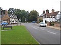
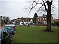
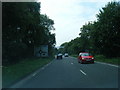
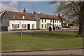
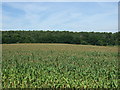
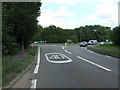
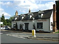
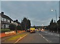

30 photos from this area
Area Information
Key information about the MK45 4AD including its size, population, and administrative classification.
- Area Type
- Postcode
- Area Size
- 2.4 hectares
- Population
- 1823
- Population Density
- 231 people/km²
House Prices in MK45 4AD
16
Properties
£280,500
Average Sold Price
£150,000
Lowest Price
£500,000
Highest Price
Showing 16 properties
| Address | Type | Beds | Baths | Last Sale Price | Last Sale Date | |
|---|---|---|---|---|---|---|
| 5 The Green, Clophill, MK45 4AD | Terraced | 2 | 1 | £292,500 | Jul 2022 | |
| 13 The Green, Clophill, MK45 4AD | Semi-detached | 2 | 1 | £315,000 | May 2021 | |
| Flat, The Green Man, The Green, Clophill, MK45 4AD | Detached | 3 | - | £500,000 | Nov 2020 | |
| 8 The Green, Clophill, MK45 4AD | Semi-detached | 2 | 1 | £150,000 | Feb 2014 | |
| 11 The Green, Clophill, MK45 4AD | Semi-detached | - | - | £247,500 | May 2004 | |
| 15 The Green, Clophill, MK45 4AD | Semi-detached | - | - | £178,000 | Mar 1998 | |
| 1 The Green, Clophill, MK45 4AD | Terraced | 2 | 1 | - | - | |
| April Cottage, 9 The Green, Clophill, MK45 4AD | Semi-detached | 4 | 1 | - | - | |
| 17 The Green, Clophill, MK45 4AD | Detached | 3 | - | - | - | |
| Flat 1, The Old Mill, High Street, Clophill, MK45 4AD | Flat | - | - | - | - |
Page 1 of 2
Energy Efficiency in MK45 4AD
Amenities
Schools
| Rank | School | Type | Entry gender | Ages |
|---|
Explore more schools in this area
Go to Schools tabDemographics
Household Size
Two person
most common
Accommodation Type
Houses
most common
Tenure
78
majority
Ethnic Group
White
most common
Religion
N/A
most common
Household Composition
N/A
most common
Age
47
median
Adults (30-64 years)
most common
Household Deprivation
N/A
with no deprivation
NS-SEC
44
in Lower managerial occupations
Explore more demographic insights in this area
Go to Demographics tabPlanning
Planning Constraints
- Flood RiskPremium
- Ramsar Wetland SitesPremium
- Area of Outstanding Natural BeautyPremium
- Protected Nature ReservePremium
- Protected WoodlandPremium