Area Overview for MK45 3PG
Photos of MK45 3PG
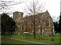
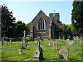
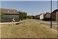
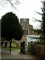


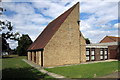
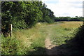
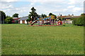
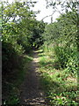
18 photos from this area
Area Information
Key information about the MK45 3PG including its size, population, and administrative classification.
- Area Type
- Postcode
- Area Size
- 6.5 hectares
- Population
- 1514
- Population Density
- 446 people/km²
House Prices in MK45 3PG
56
Properties
£372,532
Average Sold Price
£150,000
Lowest Price
£510,000
Highest Price
Showing 56 properties
| Address | Type | Beds | Baths | Last Sale Price | Last Sale Date | |
|---|---|---|---|---|---|---|
| 14 Wooding Way, Wilstead, MK45 3PG | house | - | - | £150,000 | Nov 2025 | |
| 48 Wooding Way, Wilstead, MK45 3PG | Semi-detached | 3 | 2 | £327,500 | Jul 2024 | |
| 12 Wooding Way, Wilstead, MK45 3PG | house | - | - | £154,000 | Sep 2022 | |
| 4 Wooding Way, Wilstead, MK45 3PG | house | - | - | £407,000 | May 2022 | |
| 34 Wooding Way, Wilstead, MK45 3PG | house | - | - | £485,000 | Aug 2021 | |
| 2 Wooding Way, Wilstead, MK45 3PG | Detached | 3 | 2 | £350,000 | Feb 2021 | |
| 25 Wooding Way, Wilstead, MK45 3PG | house | - | - | £466,500 | Feb 2021 | |
| 35 Wooding Way, Wilstead, MK45 3PG | house | - | - | £500,000 | Feb 2021 | |
| 15 Wooding Way, Wilstead, MK45 3PG | house | - | - | £315,000 | Jan 2021 | |
| 27 Wooding Way, Wilstead, MK45 3PG | Detached | 4 | 4 | £480,000 | Dec 2020 |
Page 1 of 6
Energy Efficiency in MK45 3PG
Amenities
Schools
| Rank | School | Type | Entry gender | Ages |
|---|
Explore more schools in this area
Go to Schools tabDemographics
Household Size
Two person
most common
Accommodation Type
Houses
most common
Tenure
88
majority
Ethnic Group
White
most common
Religion
N/A
most common
Household Composition
N/A
most common
Age
47
median
Adults (30-64 years)
most common
Household Deprivation
N/A
with no deprivation
NS-SEC
40
in Lower managerial occupations
Explore more demographic insights in this area
Go to Demographics tabPlanning
Planning Constraints
- Flood RiskPremium
- Ramsar Wetland SitesPremium
- Area of Outstanding Natural BeautyPremium
- Protected Nature ReservePremium
- Protected WoodlandPremium