Area Overview for MK45 3JT
Photos of MK45 3JT


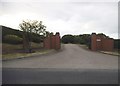


14 photos from this area
Area Information
Key information about the MK45 3JT including its size, population, and administrative classification.
- Area Type
- Postcode
- Area Size
- 1.0 km²
- Population
- 1505
- Population Density
- 156 people/km²
House Prices in MK45 3JT
22
Properties
£441,773
Average Sold Price
£150,000
Lowest Price
£900,000
Highest Price
Showing 22 properties
| Address | Type | Beds | Baths | Last Sale Price | Last Sale Date | |
|---|---|---|---|---|---|---|
| Willows, How End Road, Houghton Conquest, MK45 3JT | Bungalow | - | - | £690,000 | Feb 2024 | |
| 2 How End Road, Houghton Conquest, MK45 3JT | house | 4 | 4 | £670,000 | Oct 2020 | |
| 8 How End Road, Houghton Conquest, MK45 3JT | Terraced | 3 | - | £255,000 | May 2020 | |
| Field Farm, How End Road, Houghton Conquest, MK45 3JT | Detached | 4 | 2 | £900,000 | Nov 2019 | |
| 1 How End Road, Houghton Conquest, MK45 3JT | house | - | - | £375,000 | Aug 2010 | |
| How End House, How End Road, Houghton Conquest, MK45 3JT | Semi-detached | 4 | - | £605,000 | Jul 2009 | |
| 10 How End Road, Houghton Conquest, MK45 3JT | Terraced | - | - | £247,500 | Oct 2006 | |
| 21 How End Road, Houghton Conquest, MK45 3JT | Bungalow | 2 | 1 | £347,000 | Aug 2006 | |
| 3 How End Road, Houghton Conquest, MK45 3JT | house | - | - | £310,000 | Aug 2006 | |
| 13 How End Road, Houghton Conquest, MK45 3JT | Terraced | 4 | 3 | £310,000 | Sep 2004 |
Page 1 of 3
Energy Efficiency in MK45 3JT
Amenities
Schools
| Rank | School | Type | Entry gender | Ages |
|---|
Explore more schools in this area
Go to Schools tabDemographics
Household Size
Two person
most common
Accommodation Type
Houses
most common
Tenure
70
majority
Ethnic Group
White
most common
Religion
N/A
most common
Household Composition
N/A
most common
Age
47
median
Adults (30-64 years)
most common
Household Deprivation
N/A
with no deprivation
NS-SEC
35
in Lower managerial occupations
Explore more demographic insights in this area
Go to Demographics tabPlanning
Planning Constraints
- Flood RiskPremium
- Ramsar Wetland SitesPremium
- Area of Outstanding Natural BeautyPremium
- Protected Nature ReservePremium
- Protected WoodlandPremium