Area Overview for MK45 3HU
Photos of MK45 3HU

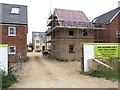
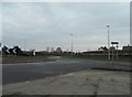
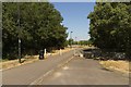
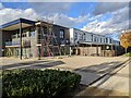
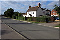
15 photos from this area
Area Information
Key information about the MK45 3HU including its size, population, and administrative classification.
- Area Type
- Postcode
- Area Size
- 7.3 hectares
- Population
- 2406
- Population Density
- 1285 people/km²
House Prices in MK45 3HU
29
Properties
£337,230
Average Sold Price
£87,500
Lowest Price
£977,000
Highest Price
Showing 29 properties
| Address | Type | Beds | Baths | Last Sale Price | Last Sale Date | |
|---|---|---|---|---|---|---|
| 167 Bedford Road, Wilstead, MK45 3HU | house | 4 | 3 | £590,000 | Aug 2024 | |
| Fairlawn, 169A Bedford Road, Wilstead, MK45 3HU | Semi-detached | - | - | £977,000 | Aug 2023 | |
| 151 Bedford Road, Wilstead, MK45 3HU | house | - | - | £385,000 | Jul 2017 | |
| 179 Bedford Road, Wilstead, MK45 3HU | house | - | - | £318,800 | May 2017 | |
| 161 Bedford Road, Wilstead, MK45 3HU | Bungalow | 2 | - | £185,000 | Dec 2014 | |
| 155 Bedford Road, Wilstead, MK45 3HU | Bungalow | - | - | £185,000 | Jun 2007 | |
| 177 Bedford Road, Wilstead, MK45 3HU | Detached | 5 | 2 | £250,000 | Jul 2006 | |
| 159 Bedford Road, Wilstead, MK45 3HU | Bungalow | - | - | £274,000 | Dec 2003 | |
| 175 Bedford Road, Wilstead, MK45 3HU | Bungalow | - | - | £120,000 | Mar 2000 | |
| 153 Bedford Road, Wilstead, MK45 3HU | Bungalow | 3 | 2 | £87,500 | Aug 1995 |
Page 1 of 3
Energy Efficiency in MK45 3HU
Amenities
Schools
| Rank | School | Type | Entry gender | Ages |
|---|
Explore more schools in this area
Go to Schools tabDemographics
Household Size
Family (3-5 people)
most common
Accommodation Type
Houses
most common
Tenure
80
majority
Ethnic Group
White
most common
Religion
N/A
most common
Household Composition
N/A
most common
Age
47
median
Adults (30-64 years)
most common
Household Deprivation
N/A
with no deprivation
NS-SEC
49
in Lower managerial occupations
Explore more demographic insights in this area
Go to Demographics tabPlanning
Planning Constraints
- Flood RiskPremium
- Ramsar Wetland SitesPremium
- Area of Outstanding Natural BeautyPremium
- Protected Nature ReservePremium
- Protected WoodlandPremium