Area Overview for MK45 2UQ
Photos of MK45 2UQ
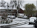
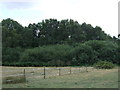
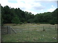
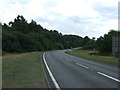
29 photos from this area
Area Information
Key information about the MK45 2UQ including its size, population, and administrative classification.
- Area Type
- Postcode
- Area Size
- 2383 m²
- Population
- 2327
- Population Density
- 253 people/km²
House Prices in MK45 2UQ
6
Properties
£109,083
Average Sold Price
£38,500
Lowest Price
£230,000
Highest Price
Showing 6 properties
| Address | Type | Beds | Baths | Last Sale Price | Last Sale Date | |
|---|---|---|---|---|---|---|
| 60 Tavistock Avenue, Ampthill, MK45 2UQ | house | 2 | - | £230,000 | Aug 2019 | |
| 52 Tavistock Avenue, Ampthill, MK45 2UQ | house | 2 | 1 | £165,000 | Jan 2015 | |
| 62 Tavistock Avenue, Ampthill, MK45 2UQ | house | 2 | - | £112,500 | Mar 2004 | |
| 56 Tavistock Avenue, Ampthill, MK45 2UQ | Terraced | - | - | £56,500 | Sep 1999 | |
| 54 Tavistock Avenue, Ampthill, MK45 2UQ | Terraced | 2 | - | £52,000 | Jun 1999 | |
| 58 Tavistock Avenue, Ampthill, MK45 2UQ | house | 2 | 1 | £38,500 | Dec 1996 |
Energy Efficiency in MK45 2UQ
Amenities
Schools
| Rank | School | Type | Entry gender | Ages |
|---|
Explore more schools in this area
Go to Schools tabDemographics
Household Size
Family (3-5 people)
most common
Accommodation Type
Houses
most common
Tenure
85
majority
Ethnic Group
White
most common
Religion
N/A
most common
Household Composition
N/A
most common
Age
47
median
Adults (30-64 years)
most common
Household Deprivation
N/A
with no deprivation
NS-SEC
51
in Lower managerial occupations
Explore more demographic insights in this area
Go to Demographics tabPlanning
Planning Constraints
- Flood RiskPremium
- Ramsar Wetland SitesPremium
- Area of Outstanding Natural BeautyPremium
- Protected Nature ReservePremium
- Protected WoodlandPremium