Area Overview for MK45 2RY
Photos of MK45 2RY
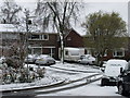
29 photos from this area
Area Information
Key information about the MK45 2RY including its size, population, and administrative classification.
- Area Type
- Postcode
- Area Size
- 1.4 hectares
- Population
- 2327
- Population Density
- 253 people/km²
House Prices in MK45 2RY
25
Properties
£373,620
Average Sold Price
£98,250
Lowest Price
£735,000
Highest Price
Showing 25 properties
| Address | Type | Beds | Baths | Last Sale Price | Last Sale Date | |
|---|---|---|---|---|---|---|
| 34 Tavistock Avenue, Ampthill, MK45 2RY | Bungalow | 4 | 2 | £600,000 | Jan 2025 | |
| 4 Tavistock Avenue, Ampthill, MK45 2RY | Detached | 4 | - | £525,000 | Dec 2024 | |
| 50 Tavistock Avenue, Ampthill, MK45 2RY | Detached | 4 | 2 | £570,000 | May 2024 | |
| 46 Tavistock Avenue, Ampthill, MK45 2RY | house | 3 | 2 | £420,000 | May 2024 | |
| 14 Tavistock Avenue, Ampthill, MK45 2RY | house | 4 | 2 | £735,000 | Jul 2023 | |
| 20 Tavistock Avenue, Ampthill, MK45 2RY | house | - | - | £560,000 | Sep 2021 | |
| 36 Tavistock Avenue, Ampthill, MK45 2RY | Bungalow | - | - | £490,000 | Jun 2021 | |
| 32 Tavistock Avenue, Ampthill, MK45 2RY | house | - | - | £502,500 | Oct 2019 | |
| 48 Tavistock Avenue, Ampthill, MK45 2RY | house | 3 | 2 | £335,000 | May 2019 | |
| 6 Tavistock Avenue, Ampthill, MK45 2RY | house | - | - | £445,000 | Oct 2015 |
Page 1 of 3
Energy Efficiency in MK45 2RY
Amenities
Schools
| Rank | School | Type | Entry gender | Ages |
|---|
Explore more schools in this area
Go to Schools tabDemographics
Household Size
Family (3-5 people)
most common
Accommodation Type
Houses
most common
Tenure
85
majority
Ethnic Group
White
most common
Religion
N/A
most common
Household Composition
N/A
most common
Age
47
median
Adults (30-64 years)
most common
Household Deprivation
N/A
with no deprivation
NS-SEC
51
in Lower managerial occupations
Explore more demographic insights in this area
Go to Demographics tabPlanning
Planning Constraints
- Flood RiskPremium
- Ramsar Wetland SitesPremium
- Area of Outstanding Natural BeautyPremium
- Protected Nature ReservePremium
- Protected WoodlandPremium