Area Overview for MK45 1XX
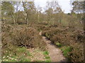
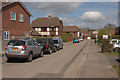
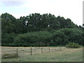
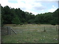
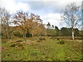
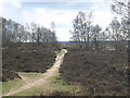
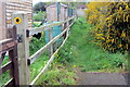
Photos of MK45 1XX


Area Information
Living in MK45 1XX offers a compact, residential experience shaped by its small cluster of homes and a population of 2,327 people. With a population density of 253 people per square kilometre, this area feels close-knit, where daily life is defined by proximity to local amenities and community routines. The median age of 47 suggests a mature demographic, with most residents aged between 30 and 64. This is a place where homeownership is strong, with 85% of properties occupied by owners rather than renters. The housing stock is predominantly single-family homes, reflecting a preference for traditional living arrangements. While the area lacks large-scale infrastructure, its small size ensures a quiet, low-traffic environment. Residents benefit from nearby schools, rail links, and retail outlets, making it a practical choice for those prioritising convenience over urban vibrancy. The absence of significant environmental constraints or flood risks adds to its appeal, though its limited size means opportunities for expansion are minimal. For buyers seeking a stable, family-oriented setting with a manageable footprint, MK45 1XX provides a straightforward, no-frills proposition.
- Area Type
- Postcode
- Area Size
- Not available
- Population
- 2327
- Population Density
- 253 people/km²
MK45 1XX is a predominantly owner-occupied area, with 85% of properties in private hands. This contrasts with rental-heavy regions, where demand for housing often outstrips supply. The housing stock is exclusively houses, not flats, which may appeal to buyers seeking space, privacy, or family-friendly layouts. Given the area’s small size and limited population, the property market is likely to be niche, with fewer options but potentially higher competition among local buyers. The high homeownership rate suggests a stable market, with properties held long-term rather than traded frequently. For buyers, this means a focus on existing homes rather than new developments. However, the lack of large-scale infrastructure or commercial zones may limit future property value growth. Those prioritising a quiet, low-density environment with established neighbours may find MK45 1XX an attractive, if unexciting, choice.
House Prices in MK45 1XX
No properties found in this postcode.
Energy Efficiency in MK45 1XX
MK45 1XX’s residents have access to a range of nearby amenities, including retail outlets such as Waitrose Little, Aldi Ampthill, and Morrisons Daily, which cater to daily shopping needs. The area’s rail network, with stations at Flitwick, Millbrook, and Lidlington, connects it to broader transport routes, while Cranfield Airport offers regional travel options. Though the data does not list parks or leisure facilities, the presence of multiple retail and transport hubs suggests a practical, service-oriented lifestyle. The compact nature of the area means amenities are within walking or short driving distance, reducing the need for long commutes. However, the absence of specific details on dining or recreational spaces leaves gaps in understanding the full character of local life. For those prioritising convenience and connectivity over large-scale leisure options, MK45 1XX provides a functional, if modest, environment.
Amenities
Schools
Residents of MK45 1XX have access to a mix of primary schools and academies, including The Firs Lower School and Redborne Upper School and Community College. The Firs Lower School operates as both a primary school and an academy with a good Ofsted rating, while Redborne Upper School and Community College functions as a primary school and an academy, also rated good. This combination provides families with options for both early education and broader schooling, though the area’s small size means these institutions serve a limited catchment. The presence of two academies with good ratings suggests a commitment to educational quality, though no secondary schools are listed in the data. For families prioritising school performance, the proximity of these institutions is a key consideration, though the lack of diversity in school types may limit choice.
| Rank | School | Type | Entry gender | Ages |
|---|
Explore more schools in this area
Go to Schools tabDemographics
MK45 1XX’s population is predominantly composed of adults aged 30 to 64, with a median age of 47. This reflects a community of established professionals and families, rather than a younger or older demographic. The high home ownership rate of 85% underscores a preference for long-term residency over rental living, suggesting stability and investment in property. All accommodation in the area is houses, not flats, which aligns with the demographic’s likely need for space and privacy. The predominant ethnic group is White, though no specific data on diversity or deprivation is provided. The age profile indicates a mature population, which may influence local services and amenities. With no data on income distribution or deprivation levels, it’s difficult to assess the area’s economic diversity, but the high homeownership and age range suggest a relatively affluent, settled community.
Household Size
Accommodation Type
Tenure
Ethnic Group
Religion
Household Composition
Age
Household Deprivation
NS-SEC
Explore more demographic insights in this area
Go to Demographics tabPlanning
Planning Constraints
- Flood RiskPremium
- Ramsar Wetland SitesPremium
- Area of Outstanding Natural BeautyPremium
- Protected Nature ReservePremium
- Protected WoodlandPremium