Area Overview for MK44 3UU
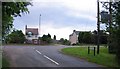
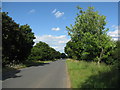
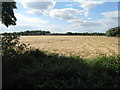
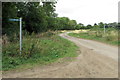
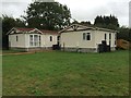
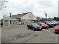
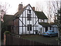
Photos of MK44 3UU


Area Information
MK44 3UU is a small residential postcode area in England, home to 1,586 people spread across a low-density neighbourhood. With a population density of 103 people per square kilometre, it reflects a quiet, close-knit community. The area’s character is defined by its mix of established homes and family-oriented living, with 82% of properties owner-occupied. This suggests a stable, long-term resident base, often centred around adults aged 30–64, the most common age group. Daily life here is shaped by proximity to local amenities, including primary schools, retail outlets, and rail links. The low crime risk score of 80 and minimal flood risk make it an attractive option for those prioritising safety. While the broadband score is poor at 26, mobile coverage is strong at 84, ensuring residents stay connected. MK44 3UU blends practicality with accessibility, offering a slice of suburban life with easy access to nearby towns via rail. For buyers seeking a low-maintenance, family-friendly environment, this area provides a straightforward, uncluttered lifestyle.
- Area Type
- Postcode
- Area Size
- Not available
- Population
- 1586
- Population Density
- 103 people/km²
MK44 3UU is primarily an owner-occupied area, with 82% of properties in private hands. This high rate of home ownership suggests a community of long-term residents rather than a rental market. The accommodation type is predominantly houses, which is unusual for a small postcode area but may indicate a focus on family homes. This housing stock appeals to buyers seeking stability and space, though the limited number of properties means the market is not expansive. The small size of the area means buyers should consider nearby zones for more options. The absence of flats or shared housing suggests a lack of high-density development, which could be a consideration for those needing alternative property types. For those prioritising ownership and family-friendly living, MK44 3UU offers a straightforward, low-risk investment. However, the limited property pool may require a broader search for comparable options.
House Prices in MK44 3UU
No properties found in this postcode.
Energy Efficiency in MK44 3UU
Residents of MK44 3UU benefit from nearby retail and transport hubs. The area’s retail landscape includes notable outlets such as Lidl Perkins, Waitrose Bedford, and Tesco Bedford, providing access to everyday shopping needs. These stores cater to both convenience and larger grocery requirements, supporting a practical lifestyle. Rail connectivity is another key feature, with stations like Sandy and Bedford offering links to broader networks. While the area itself is small, the proximity to Bedford and surrounding towns ensures access to additional amenities, including dining, leisure, and services. The combination of local shops and rail links creates a balance between self-sufficiency and external opportunities. For those valuing accessibility without urban overcrowding, MK44 3UU offers a functional, low-stress environment.
Amenities
Schools
Residents of MK44 3UU have access to two primary schools: Sheerhatch Primary School, which holds an Ofsted rating of ‘good’, and Willington Lower School. Both institutions cater to younger children, providing essential early education for families in the area. The presence of two primary schools within practical reach reduces the need for long commutes, supporting a family-oriented lifestyle. While no secondary schools are listed, the proximity to nearby towns like Bedford likely offers additional options. The ‘good’ rating at Sheerhatch indicates a reliable standard of education, though parents may wish to explore further details about curriculum or facilities. For families prioritising proximity to schools, MK44 3UU offers a solid foundation, though the limited number of institutions may necessitate a broader search for secondary education.
| Rank | School | Type | Entry gender | Ages |
|---|
Explore more schools in this area
Go to Schools tabDemographics
The community in MK44 3UU is predominantly composed of adults aged 30–64, with a median age of 47. This suggests a mature population, likely with established careers and families. Home ownership is high at 82%, indicating a strong presence of long-term residents rather than transient renters. The accommodation type is primarily houses, reflecting a preference for single-family homes over flats. The predominant ethnic group is White, though no specific diversity statistics are provided. The low population density of 103 people per square kilometre implies a spread-out, less congested living environment. While no deprivation data is available, the high home ownership and low crime risk suggest a relatively stable quality of life. The absence of protected natural areas or planning constraints may also contribute to a straightforward living experience, free from environmental restrictions. This demographic profile aligns with a community that values security, familiarity, and space.
Household Size
Accommodation Type
Tenure
Ethnic Group
Religion
Household Composition
Age
Household Deprivation
NS-SEC
Explore more demographic insights in this area
Go to Demographics tabPlanning
Planning Constraints
- Flood RiskPremium
- Ramsar Wetland SitesPremium
- Area of Outstanding Natural BeautyPremium
- Protected Nature ReservePremium
- Protected WoodlandPremium