Area Overview for MK44 3UR
Photos of MK44 3UR

Area Information
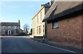
Living in MK44 3UR means being part of a tightly knit residential cluster in England, where 2,252 residents share a population density of 194 people per square kilometre. This small area is defined by its quiet, family-oriented character, with homes predominantly occupied by owners rather than renters. The community is anchored by a mix of primary schools and academies, ensuring children have access to education within walking distance. Daily life here balances suburban tranquillity with practical connectivity, as nearby railway stations like Sandy and Bedford provide links to larger towns. The area’s low crime risk score of 85 and absence of flood or environmental constraints make it appealing for those prioritising safety and stability. While the population is relatively small, the presence of retail outlets such as Lidl and Asda ensures basic needs are met locally. For buyers, MK44 3UR offers a compact, self-contained environment where proximity to amenities and schools is a key advantage.
- Area Type
- Postcode
- Area Size
- Not available
- Population
- 2252
- Population Density
- 194 people/km²
The property market in MK44 3UR is characterised by high home ownership (78%) and a predominance of houses over flats or apartments. This indicates a market skewed towards owner-occupied properties, with buyers likely seeking stable, long-term investments. The focus on houses suggests a demand for space and privacy, appealing to families or individuals who prioritise living in detached or semi-detached homes. Given the area’s small size, the housing stock is likely limited, meaning properties are not abundant but may hold value due to low supply. Buyers should consider the proximity to schools and transport as key selling points, as these amenities enhance the area’s desirability. The lack of rental properties also implies a community where residents are less likely to move frequently, reinforcing a sense of permanence.
House Prices in MK44 3UR
No properties found in this postcode.
Energy Efficiency in MK44 3UR
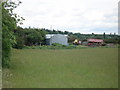
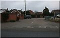
The lifestyle in MK44 3UR is defined by accessibility to essential amenities within a short distance. Five retail outlets, including The Southern Co-operative, Lidl Perkins, and Asda Sandy, provide grocery and daily shopping needs. The presence of three railway stations—Sandy, Bedford St Johns, and Bedford—enhances connectivity, allowing residents to commute to nearby towns for work or leisure. While the area lacks large parks or entertainment venues, its compact size ensures a sense of community. The mix of retail and transport options supports a practical, low-maintenance lifestyle, ideal for those who prioritise convenience over expansive leisure facilities. The area’s charm lies in its ability to meet daily needs without requiring long commutes, fostering a self-sufficient, family-friendly environment.
Amenities
Schools
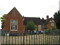
Residents of MK44 3UR have access to a range of primary and secondary education options. Great Barford Lower School and Alban VA Church of England Middle School cater to younger children, while Alban Church of England Academy and Great Barford Church of England Primary Academy provide broader educational pathways. The latter, rated 'good' by Ofsted, offers a reliable choice for families seeking quality primary education. The mix of school types ensures flexibility, with both state and church-affiliated institutions available. This diversity is beneficial for parents with specific preferences, whether they prioritise faith-based education or a broader curriculum. The proximity of schools to homes reduces commuting time, making the area attractive for families. With multiple options within walking distance, MK44 3UR supports a community where education is a central concern.
| Rank | School | Type | Entry gender | Ages |
|---|
Explore more schools in this area
Go to Schools tabDemographics
The demographic profile of MK44 3UR is shaped by a median age of 47, with the majority of residents falling into the 30-64 age bracket. This suggests a mature, established community, likely centred around families and long-term residents. Home ownership is high at 78%, indicating a stable housing market where most properties are occupied by their owners rather than tenants. The predominant accommodation type is houses, reflecting a preference for private, spacious living over flats or apartments. The area’s predominant ethnic group is White, though no specific data on diversity or deprivation levels is provided. The age range and ownership figures suggest a population that values security and continuity, with fewer young families or transient residents. This profile aligns with a neighbourhood that prioritises comfort and long-term residency over rapid change.
Household Size
Accommodation Type
Tenure
Ethnic Group
Religion
Household Composition
Age
Household Deprivation
NS-SEC
Explore more demographic insights in this area
Go to Demographics tabPlanning
Planning Constraints
- Flood RiskPremium
- Ramsar Wetland SitesPremium
- Area of Outstanding Natural BeautyPremium
- Protected Nature ReservePremium
- Protected WoodlandPremium