Area Overview for MK44 3UE
Photos of MK44 3UE
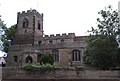

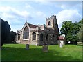
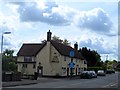

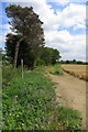
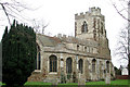
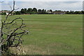
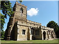
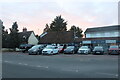
13 photos from this area
Area Information
Key information about the MK44 3UE including its size, population, and administrative classification.
- Area Type
- Postcode
- Area Size
- 11.8 hectares
- Population
- 1586
- Population Density
- 103 people/km²
House Prices in MK44 3UE
26
Properties
£425,200
Average Sold Price
£120,000
Lowest Price
£730,000
Highest Price
Showing 26 properties
| Address | Type | Beds | Baths | Last Sale Price | Last Sale Date | |
|---|---|---|---|---|---|---|
| 9 Woodlands Close, Cople, MK44 3UE | Detached | 4 | 3 | £625,000 | Mar 2025 | |
| 4 Woodlands Close, Cople, MK44 3UE | Detached | 5 | 3 | £715,000 | Dec 2024 | |
| 1 Woodlands Close, Cople, MK44 3UE | Detached | 5 | 3 | £730,000 | Aug 2024 | |
| 25 Woodlands Close, Cople, MK44 3UE | Retail | 4 | 2 | £560,500 | Aug 2022 | |
| 13 Woodlands Close, Cople, MK44 3UE | Detached | 4 | 2 | £490,000 | Apr 2021 | |
| 12 Woodlands Close, Cople, MK44 3UE | house | - | - | £585,000 | Aug 2018 | |
| 2 Woodlands Close, Cople, MK44 3UE | Detached | 4 | 2 | £520,000 | May 2016 | |
| 8 Woodlands Close, Cople, MK44 3UE | house | - | - | £425,000 | Nov 2015 | |
| 3 Woodlands Close, Cople, MK44 3UE | Terraced | 3 | - | £340,000 | Sep 2013 | |
| 10 Woodlands Close, Cople, MK44 3UE | Detached | - | - | £316,000 | Jul 2009 |
Page 1 of 3
Energy Efficiency in MK44 3UE
Amenities
Schools
| Rank | School | Type | Entry gender | Ages |
|---|
Explore more schools in this area
Go to Schools tabDemographics
Household Size
Two person
most common
Accommodation Type
Houses
most common
Tenure
82
majority
Ethnic Group
White
most common
Religion
N/A
most common
Household Composition
N/A
most common
Age
47
median
Adults (30-64 years)
most common
Household Deprivation
N/A
with no deprivation
NS-SEC
43
in Lower managerial occupations
Explore more demographic insights in this area
Go to Demographics tabPlanning
Planning Constraints
- Flood RiskPremium
- Ramsar Wetland SitesPremium
- Area of Outstanding Natural BeautyPremium
- Protected Nature ReservePremium
- Protected WoodlandPremium