Area Overview for MK44 3TP
Photos of MK44 3TP
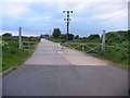
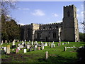
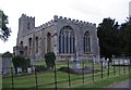
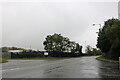
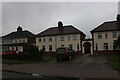
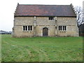
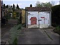
26 photos from this area
Area Information
Key information about the MK44 3TP including its size, population, and administrative classification.
- Area Type
- Postcode
- Area Size
- 77.8 hectares
- Population
- 1586
- Population Density
- 103 people/km²
House Prices in MK44 3TP
21
Properties
£350,000
Average Sold Price
£12,000
Lowest Price
£1,100,000
Highest Price
Showing 21 properties
| Address | Type | Beds | Baths | Last Sale Price | Last Sale Date | |
|---|---|---|---|---|---|---|
| Oakdale House, 3 Bedford Road, Cople, MK44 3TP | Detached | 5 | - | £1,100,000 | Aug 2021 | |
| 8 Bedford Road, Cople, MK44 3TP | Detached | 4 | 3 | £285,000 | Aug 2014 | |
| 12 Bedford Road, Cople, MK44 3TP | house | - | - | £290,000 | Jun 2014 | |
| 9 Bedford Road, Cople, MK44 3TP | Bungalow | - | - | £235,000 | Nov 2012 | |
| 11 Bedford Road, Cople, MK44 3TP | Semi-detached | - | - | £178,000 | Sep 2006 | |
| 10 Bedford Road, Cople, MK44 3TP | Semi-detached | - | - | £12,000 | Jul 1998 | |
| Tollgate Cottage, 1 Bedford Road, Cople, MK44 3TP | Detached | 3 | - | - | - | |
| PITCH 3, THE GROVE, BEDFORD ROAD, Cople, MK44 3TP | Mobile Home | - | - | - | - | |
| PITCH 4, THE GROVE, BEDFORD ROAD, Cople, MK44 3TP | Mobile Home | - | - | - | - | |
| PITCH 5C, THE GROVE, BEDFORD ROAD, Cople, MK44 3TP | Mobile Home | - | - | - | - |
Page 1 of 3
Energy Efficiency in MK44 3TP
Amenities
Schools
| Rank | School | Type | Entry gender | Ages |
|---|
Explore more schools in this area
Go to Schools tabDemographics
Household Size
Two person
most common
Accommodation Type
Houses
most common
Tenure
82
majority
Ethnic Group
White
most common
Religion
N/A
most common
Household Composition
N/A
most common
Age
47
median
Adults (30-64 years)
most common
Household Deprivation
N/A
with no deprivation
NS-SEC
43
in Lower managerial occupations
Explore more demographic insights in this area
Go to Demographics tabPlanning
Planning Constraints
- Flood RiskPremium
- Ramsar Wetland SitesPremium
- Area of Outstanding Natural BeautyPremium
- Protected Nature ReservePremium
- Protected WoodlandPremium