Area Overview for MK44 3QW
Photos of MK44 3QW
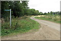
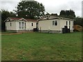
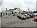
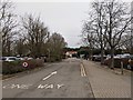
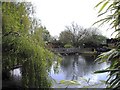
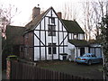
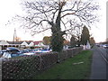
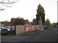
15 photos from this area
Area Information
Key information about the MK44 3QW including its size, population, and administrative classification.
- Area Type
- Postcode
- Area Size
- 1.6 hectares
- Population
- 1586
- Population Density
- 103 people/km²
House Prices in MK44 3QW
16
Properties
£403,149
Average Sold Price
£249,995
Lowest Price
£565,000
Highest Price
Showing 16 properties
| Address | Type | Beds | Baths | Last Sale Price | Last Sale Date | |
|---|---|---|---|---|---|---|
| 2 Grange Way, Willington, MK44 3QW | Detached | 4 | 2 | £495,000 | Apr 2023 | |
| 32 Grange Way, Willington, MK44 3QW | house | - | - | £565,000 | Dec 2019 | |
| 22 Grange Way, Willington, MK44 3QW | Semi-detached | - | - | £538,000 | Jul 2017 | |
| 20 Grange Way, Willington, MK44 3QW | Semi-detached | 5 | 2 | £425,000 | Jul 2015 | |
| 10 Grange Way, Willington, MK44 3QW | Semi-detached | 4 | - | £315,000 | Jun 2014 | |
| 28 Grange Way, Willington, MK44 3QW | house | 4 | - | £406,000 | May 2013 | |
| 16 Grange Way, Willington, MK44 3QW | Detached | - | - | £460,000 | Aug 2007 | |
| 6 Grange Way, Willington, MK44 3QW | Terraced | - | - | £327,500 | Sep 2005 | |
| 8 Grange Way, Willington, MK44 3QW | Terraced | - | - | £249,995 | Jul 2005 | |
| 4 Grange Way, Willington, MK44 3QW | Terraced | - | - | £249,995 | Jun 2003 |
Page 1 of 2
Energy Efficiency in MK44 3QW
Amenities
Schools
| Rank | School | Type | Entry gender | Ages |
|---|
Explore more schools in this area
Go to Schools tabDemographics
Household Size
Two person
most common
Accommodation Type
Houses
most common
Tenure
82
majority
Ethnic Group
White
most common
Religion
N/A
most common
Household Composition
N/A
most common
Age
47
median
Adults (30-64 years)
most common
Household Deprivation
N/A
with no deprivation
NS-SEC
43
in Lower managerial occupations
Explore more demographic insights in this area
Go to Demographics tabPlanning
Planning Constraints
- Flood RiskPremium
- Ramsar Wetland SitesPremium
- Area of Outstanding Natural BeautyPremium
- Protected Nature ReservePremium
- Protected WoodlandPremium