Area Overview for MK44 2TH
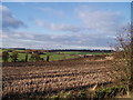
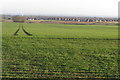
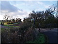
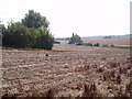
Photos of MK44 2TH


Area Information
Living in MK44 2TH means being part of a small, tightly knit residential cluster in England, home to 2,092 people spread across 154 people per square kilometre. This area is defined by its modest scale and quiet suburban character, with a population skewed toward adults aged 30–64. Daily life here is shaped by proximity to essential services, including two railway stations and a selection of retail outlets. The area’s low crime risk and absence of environmental constraints make it appealing for families and professionals seeking stability. While it lacks the density of larger towns, MK44 2TH offers a straightforward, uncluttered lifestyle. Residents benefit from easy access to primary schools, with three options within practical reach, and a mix of local shops and transport links. The area’s appeal lies in its simplicity: no sprawling developments, no overcrowding, just a steady rhythm of community life. For those prioritising safety, affordability, and practicality, MK44 2TH provides a grounded alternative to more congested regions.
- Area Type
- Postcode
- Area Size
- Not available
- Population
- 2092
- Population Density
- 154 people/km²
The property market in MK44 2TH is characterised by high home ownership (80%) and a predominance of houses over flats. This indicates a community where owner-occupation is the norm, with limited rental activity. The small size of the area means housing stock is finite, making it a niche market for buyers seeking single-family homes. The absence of large-scale developments or high-density housing suggests properties here are likely to be older, traditional homes, potentially offering character and space. For buyers, this presents both opportunities and constraints: while the area may be less competitive than larger towns, the limited supply means properties could be in demand. Proximity to rail links and schools may enhance appeal, but the small footprint of MK44 2TH means buyers must consider nearby areas for broader options.
House Prices in MK44 2TH
No properties found in this postcode.
Energy Efficiency in MK44 2TH
MK44 2TH offers a mix of retail and transport amenities within reach. Nearby shops include Morrisons Daily North, Tesco Bedford, and Tesco Clapham, providing everyday essentials. Two railway stations serve the area, offering links to broader networks. While the data does not mention parks or leisure facilities, the proximity to schools and retail suggests a focus on practicality over recreational spaces. The area’s lifestyle is defined by convenience: residents can access shopping, transport, and education without long commutes. However, the absence of specific details on parks or cultural amenities means buyers should consider whether the lack of leisure options aligns with their preferences. For those valuing straightforward, functional living, MK44 2TH delivers.
Amenities
Schools
Residents of MK44 2TH have access to three primary schools within practical reach. Renhold VC Primary School and Ravensden CofE Primary Academy both hold Ofsted ratings of 'good', while Ravensden CofE VA Primary School is also a primary institution. The presence of multiple primary schools ensures families have options for their children’s early education, though no secondary schools are listed in the data. The 'good' ratings suggest a baseline of quality in primary education, which is a key consideration for families prioritising schools. The mix of church-affiliated and state-funded schools reflects the area’s diverse educational landscape, though the absence of further details on curriculum or performance metrics means prospective buyers must investigate further for specific needs.
| Rank | School | Type | Entry gender | Ages |
|---|
Explore more schools in this area
Go to Schools tabDemographics
MK44 2TH has a median age of 47, with the majority of residents falling within the 30–64 age range. This suggests a community of established professionals and families, rather than a younger or elderly demographic. Home ownership is high at 80%, indicating a stable, long-term presence of residents. The area is predominantly composed of houses, not flats, reflecting a preference for single-family living. The predominant ethnic group is White, which aligns with broader trends in the region. The absence of specific data on deprivation or diversity means the area’s social fabric is not extensively documented, but the high home ownership rate and age profile imply a relatively affluent, settled population. For buyers, this suggests a community focused on continuity and low turnover, with residents likely prioritising long-term residency over short-term investment.
Household Size
Accommodation Type
Tenure
Ethnic Group
Religion
Household Composition
Age
Household Deprivation
NS-SEC
Explore more demographic insights in this area
Go to Demographics tabPlanning
Planning Constraints
- Flood RiskPremium
- Ramsar Wetland SitesPremium
- Area of Outstanding Natural BeautyPremium
- Protected Nature ReservePremium
- Protected WoodlandPremium