Area Overview for MK44 2JF
Photos of MK44 2JF
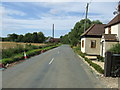
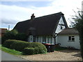
8 photos from this area
Area Information
Key information about the MK44 2JF including its size, population, and administrative classification.
- Area Type
- Postcode
- Area Size
- 27.7 hectares
- Population
- 1456
- Population Density
- 29 people/km²
House Prices in MK44 2JF
8
Properties
£295,333
Average Sold Price
£152,000
Lowest Price
£480,000
Highest Price
Showing 8 properties
| Address | Type | Beds | Baths | Last Sale Price | Last Sale Date | |
|---|---|---|---|---|---|---|
| Virginia Cottage, Keysoe Row West, Keysoe, MK44 2JF | house | 4 | - | £480,000 | Mar 2019 | |
| The Bungalow, Keysoe Row West, Keysoe, MK44 2JF | Bungalow | 2 | - | £320,000 | Apr 2015 | |
| North View, Keysoe Row West, Keysoe, MK44 2JF | Detached | 4 | - | £475,000 | Nov 2014 | |
| Summersong, Keysoe Row West, Keysoe, MK44 2JF | Detached | 2 | 1 | £185,000 | May 2004 | |
| Wayside, Keysoe Row West, Keysoe, MK44 2JF | Bungalow | - | - | £159,995 | Apr 2002 | |
| Ashwood Lodge, Keysoe Row West, Keysoe, MK44 2JF | Cottage | 5 | - | £152,000 | Dec 2001 | |
| Dogrose Top, Keysoe Row West, Keysoe, MK44 2JF | Detached | - | - | - | - | |
| Glen Cottage, Keysoe Row West, Keysoe, MK44 2JF | Semi-detached | - | - | - | - |
Energy Efficiency in MK44 2JF
Amenities
Schools
| Rank | School | Type | Entry gender | Ages |
|---|
Explore more schools in this area
Go to Schools tabDemographics
Household Size
Two person
most common
Accommodation Type
Houses
most common
Tenure
83
majority
Ethnic Group
White
most common
Religion
N/A
most common
Household Composition
N/A
most common
Age
47
median
Adults (30-64 years)
most common
Household Deprivation
N/A
with no deprivation
NS-SEC
49
in Lower managerial occupations
Explore more demographic insights in this area
Go to Demographics tabPlanning
Planning Constraints
- Flood RiskPremium
- Ramsar Wetland SitesPremium
- Area of Outstanding Natural BeautyPremium
- Protected Nature ReservePremium
- Protected WoodlandPremium