Area Overview for MK44 2HR
Photos of MK44 2HR
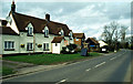
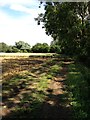
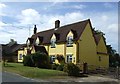

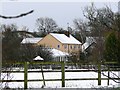
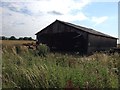

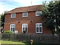
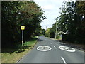
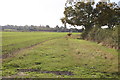
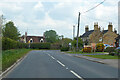
11 photos from this area
Area Information
Key information about the MK44 2HR including its size, population, and administrative classification.
- Area Type
- Postcode
- Area Size
- 3.3 km²
- Population
- 1456
- Population Density
- 29 people/km²
House Prices in MK44 2HR
36
Properties
£522,250
Average Sold Price
£118,499
Lowest Price
£1,100,000
Highest Price
Showing 36 properties
| Address | Type | Beds | Baths | Last Sale Price | Last Sale Date | |
|---|---|---|---|---|---|---|
| Willows, Pertenhall Road, Keysoe, MK44 2HR | house | - | - | £600,000 | Sep 2020 | |
| Field View, Pertenhall Road, Keysoe, MK44 2HR | Bungalow | 4 | 3 | £510,000 | Sep 2020 | |
| Walnut Tree Farm, Pertenhall Road, Keysoe, MK44 2HR | Detached | 5 | 2 | £680,000 | Jul 2020 | |
| The Little Pyghtle, Pertenhall Road, Keysoe, MK44 2HR | Cottage | 5 | - | £665,000 | Nov 2016 | |
| The Manor, Pertenhall Road, Keysoe, MK44 2HR | Detached | 6 | - | £1,100,000 | Aug 2015 | |
| Peppercorn House, Pertenhall Road, Keysoe, MK44 2HR | Detached | 3 | - | £350,000 | Jun 2015 | |
| Strathmore, Pertenhall Road, Keysoe, MK44 2HR | house | - | - | £365,000 | Apr 2015 | |
| The Hawthorns, Pertenhall Road, Keysoe, MK44 2HR | Detached | - | - | £295,000 | Feb 2007 | |
| Last Straw Cottage, Pertenhall Road, Keysoe, MK44 2HR | house | - | - | £443,000 | Apr 2002 | |
| Manor Barn, Pertenhall Road, Keysoe, MK44 2HR | Detached | - | - | £760,000 | Aug 2001 |
Page 1 of 4
Energy Efficiency in MK44 2HR
Amenities
Schools
| Rank | School | Type | Entry gender | Ages |
|---|
Explore more schools in this area
Go to Schools tabDemographics
Household Size
Two person
most common
Accommodation Type
Houses
most common
Tenure
83
majority
Ethnic Group
White
most common
Religion
N/A
most common
Household Composition
N/A
most common
Age
47
median
Adults (30-64 years)
most common
Household Deprivation
N/A
with no deprivation
NS-SEC
49
in Lower managerial occupations
Explore more demographic insights in this area
Go to Demographics tabPlanning
Planning Constraints
- Flood RiskPremium
- Ramsar Wetland SitesPremium
- Area of Outstanding Natural BeautyPremium
- Protected Nature ReservePremium
- Protected WoodlandPremium