Area Overview for MK44 1YP
Photos of MK44 1YP
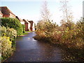
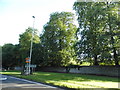
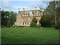
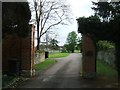
Area Information
Living in MK44 1YP means being part of a small, tightly knit residential cluster in England. With a population of 1,405 and a density of 103 people per square kilometre, this area is compact yet functional, designed for everyday convenience. The community here is predominantly composed of adults aged 30–64, reflecting a stable, mature demographic. Daily life is shaped by proximity to essential services, with two railway stations within practical reach—Bedford Railway Station and Bedford St Johns Railway Station—offering reliable connections to nearby towns. The area’s low crime risk, with a safety score of 90, ensures a secure environment for residents. While the broadband score is modest at 36, mobile coverage is strong at 84, supporting modern connectivity needs. MK44 1YP is ideal for those seeking a quiet, family-oriented setting with access to local amenities and transport links, all within a manageable footprint.
- Area Type
- Postcode
- Area Size
- Not available
- Population
- 1405
- Population Density
- 103 people/km²
MK44 1YP is primarily an owner-occupied area, with 85% of homes owned by residents rather than rented. The accommodation type is predominantly houses, which suggests a focus on family-sized properties and a more traditional housing stock. This contrasts with areas dominated by flats or rental properties, where turnover is typically higher. The small size of the postcode area means the property market is likely to be limited in scope, with fewer options for buyers. However, the high home ownership rate indicates a stable demand for existing properties, potentially reducing competition for new buyers. For those seeking a home in this area, the emphasis on houses may appeal to families or individuals prioritising space and permanence. Proximity to transport links and local amenities further enhances the area’s appeal for owner-occupiers.
House Prices in MK44 1YP
No properties found in this postcode.
Energy Efficiency in MK44 1YP
The lifestyle in MK44 1YP is shaped by its proximity to essential retail and transport hubs. Within practical reach are five retail outlets, including Budgens Clapham, Tesco Clapham, and Co-op Sharnbrook, offering everyday shopping needs. These stores provide convenience for residents, reducing the need for longer trips to larger centres. The two railway stations serve as focal points for connectivity, enabling access to wider regional amenities. While the area lacks detailed information on parks or leisure facilities, the presence of retail and transport options suggests a practical, community-focused lifestyle. The compact nature of MK44 1YP means amenities are closely clustered, supporting a self-contained environment where daily necessities are readily available. This balance of convenience and connectivity defines the area’s character for residents.
Amenities
Schools
The nearest school to MK44 1YP is Pinchmill Primary School, which holds a good Ofsted rating. This school serves the local community, offering education for younger children in a setting that meets regulatory standards. The absence of secondary schools in the immediate area means families may need to consider nearby towns for secondary education, though the primary school’s quality provides a solid foundation for early learning. The presence of a single primary school suggests a focused approach to local education, potentially reducing the need for long commutes for younger students. For families prioritising proximity to schools, Pinchmill Primary School’s good rating is a positive factor, though broader educational options would require exploration beyond MK44 1YP.
| Rank | School | Type | Entry gender | Ages |
|---|
Explore more schools in this area
Go to Schools tabDemographics
The community in MK44 1YP is defined by its demographic profile. The median age of 47 suggests a population skewed towards middle-aged and older adults, with the most common age range being 30–64 years. Home ownership is high, at 85%, indicating a strong presence of long-term residents and a stable housing market. The accommodation type is predominantly houses, reflecting a traditional, low-density residential layout. The predominant ethnic group is White, which aligns with broader regional patterns. This demographic structure means the area is likely to have established social networks and a focus on community continuity. The absence of specific deprivation data means the quality of life here appears to be supported by low crime rates and access to essential services, though further local insights would clarify this.
Household Size
Accommodation Type
Tenure
Ethnic Group
Religion
Household Composition
Age
Household Deprivation
NS-SEC
Explore more demographic insights in this area
Go to Demographics tabPlanning
Planning Constraints
- Flood RiskPremium
- Ramsar Wetland SitesPremium
- Area of Outstanding Natural BeautyPremium
- Protected Nature ReservePremium
- Protected WoodlandPremium